IMAGES TAKEN NEAR TO
Blackstaff Road, DOWNPATRICK, BT30 8SR
Introduction
This page details the photographs taken nearby to Blackstaff Road, BT30 8SR by members of the Geograph project.
The Geograph project started in 2005 with the aim of publishing, organising and preserving representative images for every square kilometre of Great Britain, Ireland and the Isle of Man.

There are currently over 7.5m images from over14,400 individuals and you can help contribute to the project by visiting https://www.geograph.org.uk
Image Map
Images are licensed for reuse under creativecommons.org/licenses/by-sa/2.0
Notes
- Clicking on the map will re-center to the selected point.
- The higher the marker number, the further away the image location is from the centre of the postcode.
Image Listing (17 Images Found)
Images are licensed for reuse under creativecommons.org/licenses/by-sa/2.0
Image
Details
Distance
1
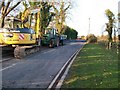
Contractors machinery on the A2 south of Blackstaff Bridge
A new water pipeline is being laid and this section of road is closed to motor traffic.
Image: © Eric Jones
Taken: 12 Nov 2010
0.10 miles
2
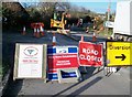
Road closed signs on the Blackstaff Road near its junction with Ford Road
Image: © Eric Jones
Taken: 12 Nov 2010
0.10 miles
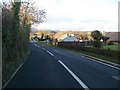
4
The junction of the Blackstaff Road (A2) and Ford Road
Ford Road leads south towards Ballykinler Camp.
Image: © Eric Jones
Taken: 12 Nov 2010
0.14 miles
5
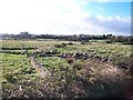
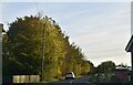
Grazing land around the head of Dundrum Inner Bay
This is mainly rough grazing land which has been reclaimed from the salt marshes.
Image: © Eric Jones
Taken: 12 Nov 2010
0.14 miles
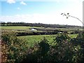
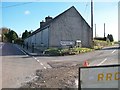
7
The A2 near the junction with the Ford Road in Ballykinler Lower
Image: © Eric Jones
Taken: 12 Nov 2010
0.19 miles
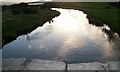
9
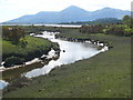
The Blackstaff River below Blackstaff Bridge
Meandering towards its estuary, with a backdrop of the Mourne mountains.
Image: © Rod Allday
Taken: 23 Apr 2011
0.20 miles
10
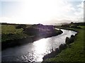
The Blackstaff River from the Blackstaff Bridge
The river drains into the Dundrum Inner Bay. The Mourne Mountains can be seen in the background.
Image: © Eric Jones
Taken: 12 Nov 2010
0.21 miles