IMAGES TAKEN NEAR TO
Claragh Road, DOWNPATRICK, BT30 8RR
Introduction
This page details the photographs taken nearby to Claragh Road, BT30 8RR by members of the Geograph project.
The Geograph project started in 2005 with the aim of publishing, organising and preserving representative images for every square kilometre of Great Britain, Ireland and the Isle of Man.

There are currently over 7.5m images from over14,400 individuals and you can help contribute to the project by visiting https://www.geograph.org.uk
Image Map
Images are licensed for reuse under creativecommons.org/licenses/by-sa/2.0
Notes
- Clicking on the map will re-center to the selected point.
- The higher the marker number, the further away the image location is from the centre of the postcode.
Image Listing (16 Images Found)
Images are licensed for reuse under creativecommons.org/licenses/by-sa/2.0
Image
Details
Distance
1
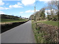
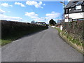
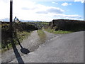
Straight section of the Claragh Road
The camera is pointing in a south-easterly direction.
Image: © Eric Jones
Taken: 10 Mar 2015
0.03 miles
2
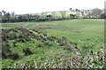
A sheugh draining a hollow wetland on the south side of Claragh Road
A sheugh is a narrow ditch or drain.
http://www.bbc.co.uk/ulsterscots/words/sheugh
Image: © Eric Jones
Taken: 10 Mar 2015
0.05 miles
4
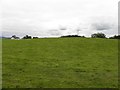
Claragh Townland
Looking WSW from Claragh Road
Image: © Kenneth Allen
Taken: 31 Aug 2011
0.10 miles
5
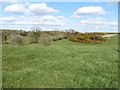
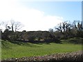
Islands of whins in fields of improved grassland
These are remnants of much wider areas of scrubland and heath.
Image: © Eric Jones
Taken: 10 Mar 2015
0.10 miles
6
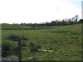
Rough grazing in a wetland hollow on the south side of Claragh Road
Image: © Eric Jones
Taken: 10 Mar 2015
0.10 miles
7
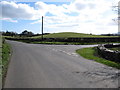
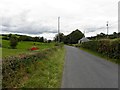
The School Road junction on the Claragh Road
Image: © Eric Jones
Taken: 10 Mar 2015
0.16 miles
9
Whin covered outcrop above the Drumanaghan Road
Image: © Eric Jones
Taken: 10 Mar 2015
0.18 miles
10
Farm access lane leading off School Road
Image: © Eric Jones
Taken: 10 Mar 2015
0.18 miles