
IMAGES TAKEN NEAR TO
Ford Road, DOWNPATRICK, BT30 8EJ
Introduction
This page details the photographs taken nearby to Ford Road, BT30 8EJ by members of the Geograph project.
The Geograph project started in 2005 with the aim of publishing, organising and preserving representative images for every square kilometre of Great Britain, Ireland and the Isle of Man.

There are currently over 7.5m images from over14,400 individuals and you can help contribute to the project by visiting https://www.geograph.org.uk
Image Map
Images are licensed for reuse under creativecommons.org/licenses/by-sa/2.0
Notes
- Clicking on the map will re-center to the selected point.
- The higher the marker number, the further away the image location is from the centre of the postcode.
Image Listing (13 Images Found)
Images are licensed for reuse under creativecommons.org/licenses/by-sa/2.0
Image
Details
Distance
1
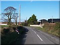
Dwellings at the northern end of Ford Road
Image: © Eric Jones
Taken: 12 Nov 2010
0.01 miles
2
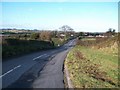
View north along Ford Road
This is the Townland of Ballykinlar Lower.
Image: © Eric Jones
Taken: 12 Nov 2010
0.03 miles
3
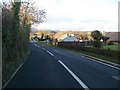
The A2 near the junction with the Ford Road in Ballykinler Lower
Image: © Eric Jones
Taken: 12 Nov 2010
0.06 miles
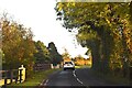
5
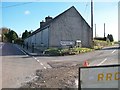
The junction of the Blackstaff Road (A2) and Ford Road
Ford Road leads south towards Ballykinler Camp.
Image: © Eric Jones
Taken: 12 Nov 2010
0.11 miles
6
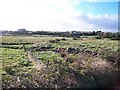
Grazing land around the head of Dundrum Inner Bay
This is mainly rough grazing land which has been reclaimed from the salt marshes.
Image: © Eric Jones
Taken: 12 Nov 2010
0.11 miles
7
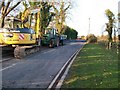
Contractors machinery on the A2 south of Blackstaff Bridge
A new water pipeline is being laid and this section of road is closed to motor traffic.
Image: © Eric Jones
Taken: 12 Nov 2010
0.16 miles
8
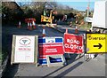
Road closed signs on the Blackstaff Road near its junction with Ford Road
Image: © Eric Jones
Taken: 12 Nov 2010
0.16 miles
9
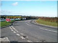
The Ford Road northwards from the Bay Road Crossroads
Image: © Eric Jones
Taken: 12 Nov 2010
0.18 miles
10
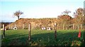
The Lismahon Motte alongside the A2 Blackstaff Road
This well documented motte was constructed in the medieval period on the site of an earlier ring fort. It is likely that the fortified building on this motte was occupied not by the Anglo-Norman or Cambro-Norman invaders, but rather by the native Irish. Unlike at nearby Clough, there is no bailey attached to the motte.
http://archaeologydataservice.ac.uk/catalogue/adsdata/arch-769-1/ahds/dissemination/pdf/vol03/3_139_176.pdf
Image: © Eric Jones
Taken: 12 Nov 2010
0.19 miles