IMAGES TAKEN NEAR TO
Bonecastle Road, DOWNPATRICK, BT30 8AE
Introduction
This page details the photographs taken nearby to Bonecastle Road, BT30 8AE by members of the Geograph project.
The Geograph project started in 2005 with the aim of publishing, organising and preserving representative images for every square kilometre of Great Britain, Ireland and the Isle of Man.

There are currently over 7.5m images from over14,400 individuals and you can help contribute to the project by visiting https://www.geograph.org.uk
Image Map
Images are licensed for reuse under creativecommons.org/licenses/by-sa/2.0
Notes
- Clicking on the map will re-center to the selected point.
- The higher the marker number, the further away the image location is from the centre of the postcode.
Image Listing (9 Images Found)
Images are licensed for reuse under creativecommons.org/licenses/by-sa/2.0
Image
Details
Distance
1
Farm and outbuildings at the Bonecastle/Vianstown Cross Roads
Image: © Eric Jones
Taken: 2 Oct 2014
0.09 miles
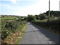
2
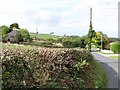
Ascending to the highest point on Bonecastle Road
South of the cross roads with Vianstown Road, Bonecastle Road traverses the ridge of a large drumlin.
Image: © Eric Jones
Taken: 2 Oct 2014
0.09 miles
3
Farmhouse near the Bonecastle/Vianstown Cross Roads
Image: © Eric Jones
Taken: 2 Oct 2014
0.10 miles
4
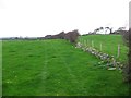
Erenagh Townland
Looking west from Bonecastle Road
Image: © Kenneth Allen
Taken: 3 Oct 2011
0.11 miles
5
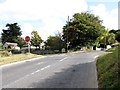
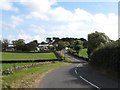
The Bonecastle/Vianstown Cross Roads viewed from the north
The two roads are used as a handy by-pass of the town to get the eastern suburbs of Downpatrick,
Image: © Eric Jones
Taken: 2 Oct 2014
0.13 miles
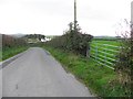
6
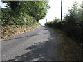
View south along Bonecastle Road
Here, Bonecastle Road begins its descent to the junction with Erenagh Road.
Image: © Eric Jones
Taken: 2 Oct 2014
0.13 miles
7
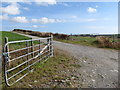
Entrance to the Downpatrick Motocross Track from Bonecastle Road
Image: © Eric Jones
Taken: 2 Oct 2014
0.14 miles
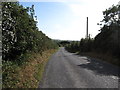
9
Bonecastle Road descending towards Ballynoe
Image: © Eric Jones
Taken: 2 Oct 2014
0.21 miles