IMAGES TAKEN NEAR TO
Ardglass Road, DOWNPATRICK, BT30 7EB
Introduction
This page details the photographs taken nearby to Ardglass Road, BT30 7EB by members of the Geograph project.
The Geograph project started in 2005 with the aim of publishing, organising and preserving representative images for every square kilometre of Great Britain, Ireland and the Isle of Man.

There are currently over 7.5m images from over14,400 individuals and you can help contribute to the project by visiting https://www.geograph.org.uk
Image Map
Images are licensed for reuse under creativecommons.org/licenses/by-sa/2.0
Notes
- Clicking on the map will re-center to the selected point.
- The higher the marker number, the further away the image location is from the centre of the postcode.
Image Listing (11 Images Found)
Images are licensed for reuse under creativecommons.org/licenses/by-sa/2.0
Image
Details
Distance
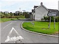
1
Milltown Road approaching the complex junction with the Ardglass Road
Image: © Eric Jones
Taken: 4 Oct 2011
0.11 miles
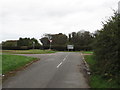
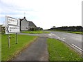
2
Cross roads on the Ardglass Road
Here, the main Ardglass-Downpatrick road is joined by two country roads - from the left by Mill Road and from the right by the Ballyshallagh Road.
Image: © Eric Jones
Taken: 4 Oct 2011
0.12 miles
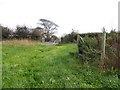
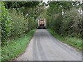
3
Ballyhosset Road
Heading ENE From Ardglass Road
Image: © Kenneth Allen
Taken: 3 Oct 2011
0.13 miles
4
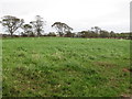
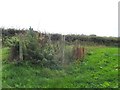
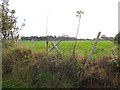
Farmland east of the Ardglass Road in the Townland of Ballyhosset
Image: © Eric Jones
Taken: 4 Oct 2011
0.13 miles
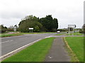
8
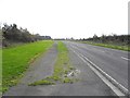
Ardglass Road, Ballyhosset
Heading south
Image: © Kenneth Allen
Taken: 3 Oct 2011
0.18 miles