IMAGES TAKEN NEAR TO
Ballyculter Road, DOWNPATRICK, BT30 7BJ
Introduction
This page details the photographs taken nearby to Ballyculter Road, BT30 7BJ by members of the Geograph project.
The Geograph project started in 2005 with the aim of publishing, organising and preserving representative images for every square kilometre of Great Britain, Ireland and the Isle of Man.

There are currently over 7.5m images from over14,400 individuals and you can help contribute to the project by visiting https://www.geograph.org.uk
Image Map
Images are licensed for reuse under creativecommons.org/licenses/by-sa/2.0
Notes
- Clicking on the map will re-center to the selected point.
- The higher the marker number, the further away the image location is from the centre of the postcode.
Image Listing (8 Images Found)
Images are licensed for reuse under creativecommons.org/licenses/by-sa/2.0
Image
Details
Distance
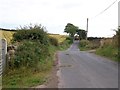
1
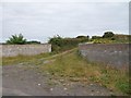
The southern end of a farm lane linking Ballyculter Road and Carrowvanny Road
This road runs along the drumlin ridge parallel with Lough Money.
Image: © Eric Jones
Taken: 29 Jul 2011
0.08 miles
2
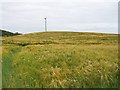
Powerlines running through cropland north of the Ballyculter Road
Image: © Eric Jones
Taken: 29 Jul 2011
0.09 miles
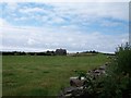
3
Hay meadow near Lough Money
This is located on the south side of Ballyculter Road. The trees on the right form a shelter belt around a farmhouse.
Image: © Eric Jones
Taken: 29 Jul 2011
0.13 miles
4
Farm house south of the Ballyculter Road
Image: © Eric Jones
Taken: 29 Jul 2011
0.15 miles
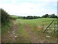
5
Farm machinery on the Ballyculter Road
Most of the traffic encountered on the walk from Ballyculter to Ballyalton consisted of agricultural machinery.
Image: © Eric Jones
Taken: 29 Jul 2011
0.17 miles
6
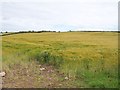
Grain crop on a drumlin overlooking Lough Money
Image: © Eric Jones
Taken: 29 Jul 2011
0.17 miles
7
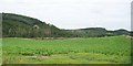
Vegetable crop on drumlin overlooking Lough Money
The tallest hill on the other side of the lake is Slievenagriddle.
Image: © Eric Jones
Taken: 29 Jul 2011
0.21 miles
8
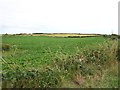
Crop land between Lough Money and Loughmoney Road, Loughmoney Townland
Image: © Eric Jones
Taken: 29 Jul 2011
0.23 miles