
IMAGES TAKEN NEAR TO
Carrowvanny Road, DOWNPATRICK, BT30 7BH
Introduction
This page details the photographs taken nearby to Carrowvanny Road, BT30 7BH by members of the Geograph project.
The Geograph project started in 2005 with the aim of publishing, organising and preserving representative images for every square kilometre of Great Britain, Ireland and the Isle of Man.

There are currently over 7.5m images from over14,400 individuals and you can help contribute to the project by visiting https://www.geograph.org.uk
Image Map
Images are licensed for reuse under creativecommons.org/licenses/by-sa/2.0
Notes
- Clicking on the map will re-center to the selected point.
- The higher the marker number, the further away the image location is from the centre of the postcode.
Image Listing (13 Images Found)
Images are licensed for reuse under creativecommons.org/licenses/by-sa/2.0
Image
Details
Distance
1
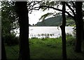
View through the trees at the northern end of Lough Money
Image: © Eric Jones
Taken: 7 Jun 2011
0.05 miles
2
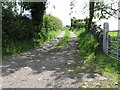
Farm track running south from Carrowvanny to the Ballyculter Road
Image: © Eric Jones
Taken: 7 Jun 2011
0.07 miles
3
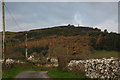
The Carrownacaw Road near Raholp (1)
The Carrownacaw Road is a minor road running eastwards from south of Raholp. It eventually becomes an impassable track. This is the view towards the west with the statue of St Patrick Image visible on the horizon.
Image: © Albert Bridge
Taken: 23 Nov 2006
0.08 miles
4
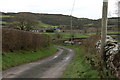
The Carrownacaw Road near Raholp (2)
See Image This is the view to the east from almost the same spot. The road becomes narrower, and the grass thicker, the further east you travel. Eventually it ends at the gate to a house. Beyond there it becomes a track shown on the map by dashes.
Image: © Albert Bridge
Taken: 23 Nov 2006
0.08 miles
5
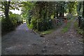
Path and track near Raholp
See Image This is the end of the road. Lough Money is out of sight behind the trees on the left. The St Patrick’s Way path is on the left and a private farm track on the right.
Image: © Albert Bridge
Taken: 6 Aug 2007
0.08 miles
6
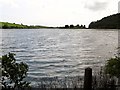
The northern end of Lough Money
Lough Money is used as a reservoir by the Northern Ireland Water Service.
Image: © Eric Jones
Taken: 7 Jun 2011
0.15 miles
7
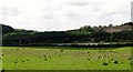
View across farmland towards Lough Money
http://www.discovernorthernireland.com/Lough-Money-Downpatrick-P2431
Image: © Eric Jones
Taken: 7 Jun 2011
0.16 miles
8
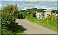
The Carrowvanny Road near Raholp
A minor road running from the crossroads with the Carrownacaw Road Image towards the northern shore of Lough Money Image The speck, on the hill, above the left-hand gatepost is the statue of St Patrick Image
Image: © Albert Bridge
Taken: 18 Jul 2008
0.19 miles
9
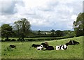
Farmland north of the Carrowvanny Road
This is an area of pastoral farming.
Image: © Eric Jones
Taken: 7 Jun 2011
0.19 miles
10
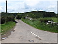
View westwards from the crossroads along the Carrowvanny Road
The Carrowvanny Road is a dead end road as far as motorists are concerned. Foot sloggers can proceed on to Saul.
Image: © Eric Jones
Taken: 7 Jun 2011
0.22 miles