IMAGES TAKEN NEAR TO
Malone Close, DOWNPATRICK, BT30 6UL

Introduction

This page details the photographs taken nearby to Malone Close, BT30 6UL by members of the Geograph project.

The Geograph project started in 2005 with the aim of publishing, organising and preserving representative images for every square kilometre of Great Britain, Ireland and the Isle of Man.

There are currently over 7.5m images from over14,400 individuals and you can help contribute to the project by visiting https://www.geograph.org.uk

Image Map


Images are licensed for reuse under creativecommons.org/licenses/by-sa/2.0
Notes
  • Clicking on the map will re-center to the selected point.
  • The higher the marker number, the further away the image location is from the centre of the postcode.

Image Listing (36 Images Found)

Images are licensed for reuse under creativecommons.org/licenses/by-sa/2.0
  • ...
Image
Details
Distance
1
Strangford Road by the Downpatrick Cricket Ground
Image: © Eric Jones Taken: 25 Jun 2013
0.09 miles
2
The Strangford Road Grounds of Downpatrick Cricket Club
The club plays in the Northern Cricket Union (NCU) Senior League. The ground is also known as The Meadows.
Image: © Eric Jones Taken: 22 Apr 2017
0.10 miles
3
Old Belfast Road sign, Downpatrick
Sign on the Old Belfast Road (town end) showing the townland as Demesne of Down - one well above the average size.
Image: © Albert Bridge Taken: 6 Oct 2010
0.13 miles
4
Downpatrick Cricket Club
Downpatrick Crick Club (founded 1849) sits between the Old Belfast and Strangford Roads.
Image: © Albert Bridge Taken: 6 Oct 2010
0.13 miles
5
Vacant house, Downpatrick
A vacant house near the start of the Old Belfast Road. The garden (out of picture to the left) has what looks like the fallen remains of an estate agent’s “for sale” sign.
Image: © Albert Bridge Taken: 6 Oct 2010
0.13 miles
6
Houses in New Bridge Street, Downpatrick
This image was taken from the A7 (Belfast Road).
Image: © Eric Jones Taken: 4 Mar 2014
0.14 miles
7
Road markings, Downpatrick
Self-explanatory markings on the Old Belfast Road.
Image: © Albert Bridge Taken: 6 Oct 2010
0.14 miles
8
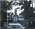
The War Memorial, Downpatrick
This is located at the junction of the A22 and Strangford Road.
Image: © Eric Jones Taken: 20 Jul 2017
0.15 miles
9
The junction of the A25 (Strangford Road) and the A22 (Killyleagh Road) on the north side of Downpatrick
Image: © Eric Jones Taken: 25 Jun 2013
0.15 miles
10
Downpatrick war memorial
Downpatrick war memorial was designed and erected by two locals – Messrs S & T Hastings. It is made from Portland stone and depicts a rifleman. It has not weathered too well.
Image: © Albert Bridge Taken: 4 Dec 2007
0.15 miles
  • ...