
IMAGES TAKEN NEAR TO
Henrietta Street, BELFAST, BT2 8LW
Introduction
This page details the photographs taken nearby to Henrietta Street, BT2 8LW by members of the Geograph project.
The Geograph project started in 2005 with the aim of publishing, organising and preserving representative images for every square kilometre of Great Britain, Ireland and the Isle of Man.

There are currently over 7.5m images from over14,400 individuals and you can help contribute to the project by visiting https://www.geograph.org.uk
Image Map
Images are licensed for reuse under creativecommons.org/licenses/by-sa/2.0
Notes
- Clicking on the map will re-center to the selected point.
- The higher the marker number, the further away the image location is from the centre of the postcode.
Image Listing (1130 Images Found)
Images are licensed for reuse under creativecommons.org/licenses/by-sa/2.0
Image
Details
Distance
1
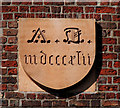
St Malachy's (RC) church, Belfast (4)
The datestone on the Joy Street side Image
Image: © Albert Bridge
Taken: 11 Apr 2011
0.03 miles
2
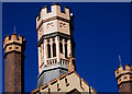
St Malachy's (RC) church, Belfast (5)
The turrets (octagonal) and castellations on the Joy Street side Image
Image: © Albert Bridge
Taken: 11 Apr 2011
0.03 miles
3
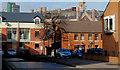
Catherine Street, Belfast
The present Catherine Street (off Cromac Street) follows a similar line to its mid-19th century predecessor. Today’s is a cul-de-sac for vehicles but it's still possible to walk through to Hamilton Street.
Image: © Albert Bridge
Taken: 17 Feb 2010
0.04 miles
4
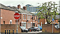
Russell Place, Belfast (September 2018)
Russell Place is a cul-de-sac - a redeveloped continuation of the former Russell Street towards Cromac Street (hidden in the background). Last seen in February 2012 Image
Image: © Albert Bridge
Taken: 15 Sep 2018
0.04 miles
5
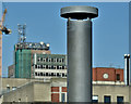
Sewer ventilation pipe, Cromac Street, Belfast (April 2017)
A sewer ventilation pipe beside the Eliza Street car park - one of many installed during the reconstruction of Belfast’s sewers some years ago Image Today’s pipes are not quite as elaborate as they used to be Image
Image: © Albert Bridge
Taken: 2 Apr 2017
0.04 miles
6
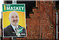
Election poster, Belfast (3)
In Cromac Street, almost opposite Eliza Street Image
Image: © Albert Bridge
Taken: 3 Apr 2011
0.04 miles
7
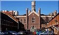
St Malachy's (RC) church, Belfast (3)
The rear of elaborate buildings tends to be plain or utilitarian. St Malachy’s is an exception where the back (Joy Street) is almost as distinguished as the front Image The view is along Henrietta Street.
Image: © Albert Bridge
Taken: 11 Apr 2011
0.04 miles
8
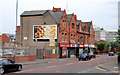
Cromac Street, Belfast (3)
See Image The houses have all been redeveloped but this row of shops (between Catherine Street and Henrietta Street) lies vacant. Continue to Image (May 2013).
Image: © Albert Bridge
Taken: 28 Jun 2010
0.04 miles
10
Eliza Street car park, Belfast
See Image Most (if not all) NCP-staffed Roads Service car parks seem to have been converted to pay and display. Checking is done by mobile NCP attendants on mopeds.
Image: © Albert Bridge
Taken: 15 May 2013
0.04 miles