
IMAGES TAKEN NEAR TO
Stonebridge Meadows, LISBURN, BT28 3JD
Introduction
This page details the photographs taken nearby to Stonebridge Meadows, BT28 3JD by members of the Geograph project.
The Geograph project started in 2005 with the aim of publishing, organising and preserving representative images for every square kilometre of Great Britain, Ireland and the Isle of Man.

There are currently over 7.5m images from over14,400 individuals and you can help contribute to the project by visiting https://www.geograph.org.uk
Image Map
Images are licensed for reuse under creativecommons.org/licenses/by-sa/2.0
Notes
- Clicking on the map will re-center to the selected point.
- The higher the marker number, the further away the image location is from the centre of the postcode.
Image Listing (10 Images Found)
Images are licensed for reuse under creativecommons.org/licenses/by-sa/2.0
Image
Details
Distance
1
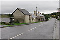
Stoneyford village
A few of the older houses and farm buildings in the middle of Stoneyford. The village has expanded quite a bit in recent years with mostly more modern houses.
Image: © Robert Ashby
Taken: 20 Oct 2013
0.10 miles
2
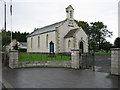
St John's, Stoneyford
The Church of Ireland Parish Church. The normal Service is from the Book of Common Prayer.
Image: © Brian Shaw
Taken: 28 Sep 2005
0.10 miles
3
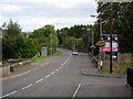
Stoneyford Village (3/3)
Looking along the Stoneyford Road towards the Stoneyford River. Note the mid-recession house price cut - the new development falls below the £100,000 mark.
Image: © Dean Molyneaux
Taken: 25 Sep 2009
0.10 miles
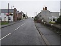
5
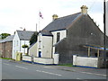
Stoneyford Orange Hall
Erected in 1898 - one of the oldest building in this small linear settlement.
Image: © Dean Molyneaux
Taken: 25 Sep 2009
0.12 miles
6
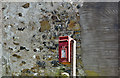
Postbox BT28 73, Stoneyford (May 2017)
Post-mounted EIIR postbox (BT28 73) close to The Mews.
Image: © Albert Bridge
Taken: 6 May 2017
0.13 miles
7

Entering Stoneyford on the Ballypitmave Road
Approaching from the direction of Glenavy on the Ballypitmave Road.
Image: © Dean Molyneaux
Taken: 16 Mar 2014
0.14 miles
8
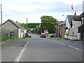
Stoneyford Village (1/3)
The main body of this quiet County Antrim village, with its phone box and Orange Hall.
Image: © Dean Molyneaux
Taken: 25 Sep 2009
0.16 miles
9
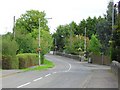
Stoneyford Village (2/3)
Looking towards the Stoneyford River bridge.
Image: © Dean Molyneaux
Taken: 25 Sep 2009
0.20 miles
10
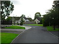
Stonebridge Court, Stoneyford
One of five housing developments in this small village.
Image: © Dean Molyneaux
Taken: 25 Sep 2009
0.21 miles