
IMAGES TAKEN NEAR TO
Portman Business Park, LISBURN, BT28 2XF
Introduction
This page details the photographs taken nearby to Portman Business Park, BT28 2XF by members of the Geograph project.
The Geograph project started in 2005 with the aim of publishing, organising and preserving representative images for every square kilometre of Great Britain, Ireland and the Isle of Man.

There are currently over 7.5m images from over14,400 individuals and you can help contribute to the project by visiting https://www.geograph.org.uk
Image Map
Images are licensed for reuse under creativecommons.org/licenses/by-sa/2.0
Notes
- Clicking on the map will re-center to the selected point.
- The higher the marker number, the further away the image location is from the centre of the postcode.
Image Listing (14 Images Found)
Images are licensed for reuse under creativecommons.org/licenses/by-sa/2.0
Image
Details
Distance
1
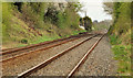
Railway at Lissue near Lisburn
The Belfast – Dublin railway (welded rail on concrete sleepers) on the Portadown/Dublin side of Lissue level crossing Image The level crossing Image at the closed Maze station is in the background. The Google map shows a non-existent station under the name of “Mazetown”.
Image: © Albert Bridge
Taken: 8 Apr 2012
0.11 miles
2
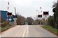
Railway Crossing at Lissue Road
Looking towards the Moira Road
Image: © Wilson Adams
Taken: 25 Mar 2007
0.12 miles
3
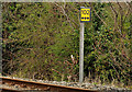
Railway milepost, Lissue near Lisburn
Milepost 102¾ (from Dublin), beside the down line on the Portadown/Dublin side of Lissue level crossing Image Image shows 102½.
Image: © Albert Bridge
Taken: 8 Apr 2012
0.13 miles
4
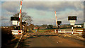
Lissue level crossing near Lisburn
See Image An earlier view of the crossing, looking in the opposite direction, showing the original style of NIR half-barrier crossing. The black box (left) marked “T”, housed the public phone to Knockmore Jct signal cabin Image Image shows the crossing in April 2012.
Image: © Albert Bridge
Taken: 23 Feb 1974
0.13 miles
5
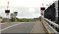
Lissue level crossing near Lisburn (2012)
See Image (February 1974). The same level crossing 38 years later. It has the current style of remotely-monitored half barriers. The Lissue Road, then a country road is now part of Lisburn.
Image: © Albert Bridge
Taken: 8 Apr 2012
0.13 miles
6
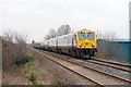
The Belfast to Dublin Enterprise
The 10:00am Belfast to Dublin Enterprise approaching Lissue Crossing
Image: © Wilson Adams
Taken: 25 Mar 2007
0.14 miles
7

Former Maze station near Lisburn
The little-used station at The Maze closed in 1974. Since then nature has done its best to reclaim the platforms. This view is towards Lisburn with the up platform in the foreground. Image shows the station in March 1985 when the passenger building, on the down platform, still existed.
Image: © Albert Bridge
Taken: 8 Apr 2012
0.21 miles
8
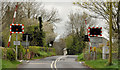
The Maze level crossing near Lisburn
The level crossing taking the Belfast – Dublin (left) railway across a minor road called Cross Lane. The platforms of the former Maze station (closed 1974) are on the right. The Google map shows a non-existent station under the name of “Mazetown”.
Image: © Albert Bridge
Taken: 8 Apr 2012
0.21 miles
9
Railway milepost, The Maze near Lisburn
Milepost 102½ (from Dublin), beside the down line on the Portadown/Dublin side of the Maze level crossing Image The next milepost (102¾) Image is at Lissue level crossing Image
Image: © Albert Bridge
Taken: 8 Apr 2012
0.22 miles
10
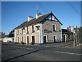
Maze Station Hotel
On the side of the building is a legend "Maze Station Hotel 1831". Interesting - the railway did not reach Maze until about 1841! Perhaps an attempt to climb on the bandwagon of the time.
Image: © Brian Shaw
Taken: 7 Nov 2005
0.25 miles