IMAGES TAKEN NEAR TO
Mornington Lane, LISBURN, BT28 2WH

Introduction

This page details the photographs taken nearby to Mornington Lane, BT28 2WH by members of the Geograph project.

The Geograph project started in 2005 with the aim of publishing, organising and preserving representative images for every square kilometre of Great Britain, Ireland and the Isle of Man.

There are currently over 7.5m images from over14,400 individuals and you can help contribute to the project by visiting https://www.geograph.org.uk

Image Map


Images are licensed for reuse under creativecommons.org/licenses/by-sa/2.0
Notes
  • Clicking on the map will re-center to the selected point.
  • The higher the marker number, the further away the image location is from the centre of the postcode.

Image Listing (16 Images Found)

Images are licensed for reuse under creativecommons.org/licenses/by-sa/2.0
Image
Details
Distance
1
Steam locomotive no 85, Knockmore, Lisburn (May 2014)
Shortly after the passing of the up “Enterprise” Image, 85 followed with the “Saint Canice Railtour” Image
Image: © Albert Bridge Taken: 15 May 2014
0.09 miles
2
Two trains, Knockmore, Lisburn (September 2014)
The 09.45 Portadown – Bangor (3005 – left) and the 08.57 Bangor – Portadown (3012) pass between the Ballinderry Road (background) and the Knockmore Road bridges. The “mothballed” Antrim line Image is on the left.
Image: © Albert Bridge Taken: 6 Sep 2014
0.10 miles
3
Former ABN mill, Lisburn
The former ABN Knockmore animal feed mill on the A3 Moira Road. Viewed from a Belfast bound train from Dublin.
Image: © Thomas Nugent Taken: 1 Jun 2019
0.15 miles
4
Mornington, Lisburn (2)
See Image Houses to the right (west) of those in the link. This photograph appears as a matter of geographical and historical record only. I have no connection with any of the parties involved in the development.
Image: © Albert Bridge Taken: 14 Apr 2013
0.16 miles
5
Proposed park and ride, Knockmore, Lisburn - May 2016(2)
The approximate site for the proposed Knockmore park and ride station. The single Antrim line is on the left.
Image: © Albert Bridge Taken: 7 May 2016
0.17 miles
6
Mornington, Lisburn (1)
Part of a new development of houses, for sale or rent, under construction on the southern side of the Ballinderry Road. This photograph appears as a matter of geographical and historical record only. I have no connection with any of the parties involved in the development. See also Image
Image: © Albert Bridge Taken: 14 Apr 2013
0.17 miles
7
Heatheringtons' shirt factory, Lisburn
Back in the early/mid-1970’s there was a demand for warehousing and commercial premises, outside Belfast, which the private sector was reluctant to meet. The Department of Commerce undertook two schemes in Lisburn. One was a “design and build” contract (Bellisle Building Company Limited) at Hull’s Hill, on the Moira Road and this one, on the Ballinderry Road, where serviced sites were provided, on long leases, around an estate road (engineers McAdam Design Partnership). The area still exists, privatised, re-named and expanded. Heatheringtons was one of the early occupants. Image shows a similar view in 2013.
Image: © Albert Bridge Taken: 13 May 1976
0.17 miles
8
Warehouses, Lisburn (1)
Warehouses, on the Ballinderry Road, at the corner of Enterprise Crescent. They are built on this site Image
Image: © Albert Bridge Taken: 14 Apr 2013
0.17 miles
9
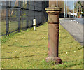
Boundary post, Lisburn (3)
A town boundary post, on the Ballinderry Road, on the inward side of Mornington Image (middle top). Image shows the inscription.
Image: © Albert Bridge Taken: 14 Apr 2013
0.18 miles
10
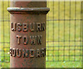
Boundary post, Lisburn (4)
See Image The inscription.
Image: © Albert Bridge Taken: 14 Apr 2013
0.18 miles