
IMAGES TAKEN NEAR TO
Mullaghcarton Road, LISBURN, BT28 2TB
Introduction
This page details the photographs taken nearby to Mullaghcarton Road, BT28 2TB by members of the Geograph project.
The Geograph project started in 2005 with the aim of publishing, organising and preserving representative images for every square kilometre of Great Britain, Ireland and the Isle of Man.

There are currently over 7.5m images from over14,400 individuals and you can help contribute to the project by visiting https://www.geograph.org.uk
Image Map
Images are licensed for reuse under creativecommons.org/licenses/by-sa/2.0
Notes
- Clicking on the map will re-center to the selected point.
- The higher the marker number, the further away the image location is from the centre of the postcode.
Image Listing (12 Images Found)
Images are licensed for reuse under creativecommons.org/licenses/by-sa/2.0
Image
Details
Distance
1
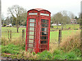
Telephone box near Brookmount, Lisburn
A weather beaten “K” type on the Mullaghcarton Road, near Cross Lane.
Image: © Albert Bridge
Taken: 8 Dec 2012
0.08 miles
2

Railway Bridge
This bridge carries the single-track line (standard Irish gauge of 5'3") from Knockmore Junction (to the left) to Antrim.
Image: © Brian Shaw
Taken: 10 Jan 2006
0.13 miles
3

Pylon and power lines, Brookmount near Lisburn
A pylon and power lines, on the western side of Cross Lane, near the railway bridge. This is the continuation of the grid from near Young’s Bridge Image where it had previously been underground. For the pylons to the north see Image
Image: © Albert Bridge
Taken: 8 Dec 2012
0.15 miles
4

Field gate, Brookmount, Lisburn
A modern field gate, in a traditional style, at Cross Lane, close to this railway bridge Image
Image: © Albert Bridge
Taken: 23 Mar 2014
0.18 miles
5
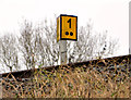
Railway milepost, Brookmount near Lisburn
Milepost 1½ on the Brookmount/Antrim side of the bridge over Cross Lane Image The distance is measured from Knockmore Image
Image: © Albert Bridge
Taken: 8 Dec 2012
0.18 miles
6
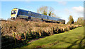
Diverted train, Brookmount, Lisburn (March 2014)
Image: © Albert Bridge
Taken: 23 Mar 2014
0.18 miles
7
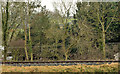
Railway at Brookmount near Lisburn
The view, from the gate of Magheragall church, showing the “mothballed” Lisburn – Antrim railway, between the Cross Lane bridge Image (out of picture to the left) and the site of the former Brookmount station.
Image: © Albert Bridge
Taken: 8 Dec 2012
0.18 miles
8
Railway bridge, Brookmount near Lisburn (3)
The “bridge strike” sign on the southern side of the bridge. Part of the emergency number has been removed to avoid misuse by pranksters.
Image: © Albert Bridge
Taken: 8 Dec 2012
0.18 miles
9
Railway bridge, Brookmount near Lisburn (1)
The view, from the gate of Magheragall church, showing the bridge passing over Cross Lane. Antrim is to the right.
Image: © Albert Bridge
Taken: 8 Dec 2012
0.19 miles
10
Railway bridge, Brookmount near Lisburn (2)
The southern side of the bridge.
Image: © Albert Bridge
Taken: 8 Dec 2012
0.19 miles