
IMAGES TAKEN NEAR TO
Laganville Park, LISBURN, BT28 2GF
Introduction
This page details the photographs taken nearby to Laganville Park, BT28 2GF by members of the Geograph project.
The Geograph project started in 2005 with the aim of publishing, organising and preserving representative images for every square kilometre of Great Britain, Ireland and the Isle of Man.

There are currently over 7.5m images from over14,400 individuals and you can help contribute to the project by visiting https://www.geograph.org.uk
Image Map
Images are licensed for reuse under creativecommons.org/licenses/by-sa/2.0
Notes
- Clicking on the map will re-center to the selected point.
- The higher the marker number, the further away the image location is from the centre of the postcode.
Image Listing (34 Images Found)
Images are licensed for reuse under creativecommons.org/licenses/by-sa/2.0
Image
Details
Distance
1
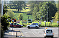
The Knockmore Road, Lisburn (September 2014)
The Knockmore Road as it approaches the Moira Road. The site for the proposed new road is in the background
Image: © Albert Bridge
Taken: 6 Sep 2014
0.07 miles
2
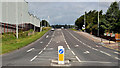
Knockmore Road, Lisburn
There used to be a narrow country road called Knockmore Lane. It ran, northwards, from the Moira Road (foregrround) and crossed the railway by a level crossing Image and Image where there was never an impatient queue when gates were across the road. Then Lisburn expanded, to the west and north, and the lane disappeared. Knockmore Road (part of a network of spine and distributor roads) now crosses the railway by a bridge.
Image: © Albert Bridge
Taken: 28 Aug 2011
0.08 miles
3
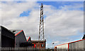
Pylon and power lines, Lisburn (2)
See Image A pylon and power lines, in the midst of commercial premises, opposite Flush Park, close to the Knockmore Road Image The line continues to Image
Image: © Albert Bridge
Taken: 28 Aug 2011
0.11 miles
4
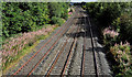
Railway, Knockmore, Lisburn (1)
The view, towards Lisburn, from the Knockmore Road Image bridge which replaced the level crossing Image and Image The “mothballed” third line from Antrim http://www.geograph.org.uk/search.php?i=24361101 is on the left. The down line from Dublin is in the middle and the up line is on the right. Image shows the view towards Dublin.
Image: © Albert Bridge
Taken: 28 Aug 2011
0.11 miles
5
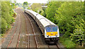
The "Enterprise", Knockmore, Lisburn (May 2014)
The 10.35 Belfast – Dublin “Enterprise” (driving trailer 9003 leading) approaching the Knockmore Road bridge Image The mothballed (and rusty) Antrim line http://www.geograph.org.uk/snippet/5646 is on the left.
Image: © Albert Bridge
Taken: 15 May 2014
0.12 miles
6
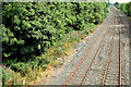
The Antrim line, Knockmore, Lisburn (July 2014)
The single “mothballed” and rusty Lisburn - Antrim line beside the double-track former Great Northern main line to Portadown and Dublin (right). The site for the proposed park and ride car park Image is behind the line of trees on the left.
Image: © Albert Bridge
Taken: 31 Jul 2014
0.12 miles
7
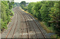
Railway lines, Knockmore, Lisburn (July 2014)
The single “mothballed” and rusty Lisburn - Antrim line (looking towards Lisburn) beside the double-track former Great Northern main line to Portadown and Dublin (right). The site for the proposed park and ride car park Image is behind the line of trees on the left. There is no space here for a mainline down platform and limited space for an up platform. The layman is tempted to wonder whether the Antrim line will be removed and replaced by a junction as was once the arrangement Image
Image: © Albert Bridge
Taken: 31 Jul 2014
0.12 miles
8
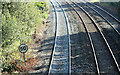
The Antrim line, Knockmore, Lisburn (September 2014)
The “mothballed” Antrim line (left), now with a coating of new ballast, looking towards Lisburn, from the Knockmore Road bridge.
Image: © Albert Bridge
Taken: 6 Sep 2014
0.12 miles
9
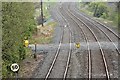
Proposed park and ride, Knockmore, Lisburn - May 2016(2)
The approximate site for the proposed Knockmore park and ride station. The single Antrim line is on the left.
Image: © Albert Bridge
Taken: 7 May 2016
0.12 miles
10
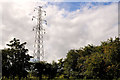
Pylon and power lines, Lisburn (3)
A pylon and power lines, on the southern side of the Moira Road, close to the Knockmore Road Image They are a continuation of Image on the Saintfield Road. Image shows the next, but one, in the grid.
Image: © Albert Bridge
Taken: 28 Aug 2011
0.13 miles