IMAGES TAKEN NEAR TO
Causeway Meadows, LISBURN, BT28 2GD

Introduction

This page details the photographs taken nearby to Causeway Meadows, BT28 2GD by members of the Geograph project.

The Geograph project started in 2005 with the aim of publishing, organising and preserving representative images for every square kilometre of Great Britain, Ireland and the Isle of Man.

There are currently over 7.5m images from over14,400 individuals and you can help contribute to the project by visiting https://www.geograph.org.uk

Image Map


Images are licensed for reuse under creativecommons.org/licenses/by-sa/2.0
Notes
  • Clicking on the map will re-center to the selected point.
  • The higher the marker number, the further away the image location is from the centre of the postcode.

Image Listing (20 Images Found)

Images are licensed for reuse under creativecommons.org/licenses/by-sa/2.0
Image
Details
Distance
1
Warehouses, Lisburn (2)
See Image Warehouses, at Enterprise Crescent, on the northern side of the Lisburn Enterprise Centre.
Image: © Albert Bridge Taken: 14 Apr 2013
0.07 miles
2
Iniscarn, Lisburn
Social housing between the Ballinderry Road (behind me) and the Causeway End Road.
Image: © Albert Bridge Taken: 14 Apr 2013
0.21 miles
3
Ballinderry Road
Car dealership at the junction of Ballinderry Rd and Enterprise Avenue at the western edge of Lisburn.
Image: © Robert Ashby Taken: 25 Sep 2013
0.22 miles
4
Foot and cycle path, Laurelhill, Lisburn - March 2016(2)
See Image The view is the opposite direction – towards the Laurelhill Road.
Image: © Albert Bridge Taken: 21 Mar 2016
0.23 miles
5
Train at Knockmore halt
One of NIR's MED sets pauses at Knockmore halt on the Lisburn - Antrim line with the 15.50 passenger train from Lisburn to Antrim, running 30 minutes late. Due to a long planning dispute, the direct line from Lisburn to the former Antrim branch junction at Knockmore did not open until 1977. However, the entire Lisburn - Antrim line closed on 29 June 2003 and is currently mothballed.
Image: © The Carlisle Kid Taken: 14 Jun 1977
0.23 miles
6
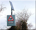
Solar panel, Lisburn
A solar panel powering flashing lights on a “school” sign, on the Ballinderry Road, just outward of the former Knockmore station Image
Image: © Albert Bridge Taken: 13 Mar 2011
0.23 miles
7
"Sealink train". Knockmore, Lisburn
See Image The “Sealink” set passing Knockmore station with the 17.45 Portadown – Bangor. The platform on the other side of the Ballinderry Road bridge served the (single) third line to Antrim. That on the right was used by up trains to Portadown on the Dublin line. Due to insufficient space there was no equivalent down platform. The semaphore signal is the Lisburn down distant.
Image: © Albert Bridge Taken: 27 Aug 1984
0.24 miles
8
Foot and cycle path, Laurelhill, Lisburn - March 2016(1)
A segregated foot and cycle path, at Laurelhill, below the Prince William Road spine road (left). This design had been used, in the late 1960’s, in the new city of Craigavon. At that time it was considered highly innovative though (I think) the concept had originated in Milton Keynes Image Image shows the view in the other direction.
Image: © Albert Bridge Taken: 21 Mar 2016
0.24 miles
9
Ballinderry Road Bridge/Knockmore Halt
(right) Knockmore Halt on the Lisburn to Antrim Branch, (centre and left) the Belfast to Dublin mainline. The Ballindery Road bridge in the centre of the photo, this replaced the level crossing that was previously at this location in the 1920's. It should also be noted that trains don't stop at the Halt any more.
Image: © Wilson Adams Taken: 13 Apr 2008
0.24 miles
10
Former Knockmore station, Lisburn
The 11.15 Portadown – Bangor passing under the Ballinderry Road bridge. The closed Knockmore station Image and the “mothballed” third line Image and Image are on the right. The view is from the Causeway End Road bridge.
Image: © Albert Bridge Taken: 19 Oct 2010
0.24 miles