IMAGES TAKEN NEAR TO
Knockmore Industrial Estate, Moira Road, LISBURN, BT28 2EJ

Introduction

This page details the photographs taken nearby to Knockmore Industrial Estate, Moira Road, BT28 2EJ by members of the Geograph project.

The Geograph project started in 2005 with the aim of publishing, organising and preserving representative images for every square kilometre of Great Britain, Ireland and the Isle of Man.

There are currently over 7.5m images from over14,400 individuals and you can help contribute to the project by visiting https://www.geograph.org.uk

Image Map


Images are licensed for reuse under creativecommons.org/licenses/by-sa/2.0
Notes
  • Clicking on the map will re-center to the selected point.
  • The higher the marker number, the further away the image location is from the centre of the postcode.

Image Listing (29 Images Found)

Images are licensed for reuse under creativecommons.org/licenses/by-sa/2.0
  • ...
Image
Details
Distance
1
Signal cabin, Knockmore Jct, near Lisburn
Knockmore was where GNR(I) lines to Antrim and Banbridge/Castlewellan left the Belfast – Dublin line. The Castlewellan line closed in 1955. The junction with the Antrim branch closed in 1977 when the line was extended to Lisburn station. In this view the conductor of the 17.05 Antrim – Lisburn is preparing to surrender the single-line tablet to the Knockmore signalman. This was a rural junction with a level crossing taking a country road across the railway. It is now suburban and commercial Lisburn with a wide road crossing the line by an overbridge.
Image: © Albert Bridge Taken: 14 Aug 1976
0.09 miles
2
Warehouses, Knockmore, Lisburn (May 2016)
The greenfield site, between the Moira Road and the then Knockmore Lane was vested by the Ministry of Commerce in the early 1970’s and developed, on a “design and build” basis, by a private builder. Subsequently redeveloped as shown. See also Image (May 1976).
Image: © Albert Bridge Taken: 7 May 2016
0.10 miles
3
Railway, Knockmore, Lisburn (2)
See Image The view, from the same bridge, in the other direction, towards Portadown and Dublin. The up Dublin line is on the left. The down Dublin line is in the middle and the rusty “mothballed” third line from Antrim is on the right. This is the approximate site of the former Knockmore Jct Image and Image from which the branch to Banbridge and Castlewellan Image also diverged.
Image: © Albert Bridge Taken: 28 Aug 2011
0.10 miles
4
The Burnhouse bridge, Lisburn (1)
The Burnhouse bridge carried the Moira Road across the Knockmore Jct Image – Banbridge/Castlewellan branch Image of the GNR(I) (1863-1956). The name comes from the adjacent Burnhouse animal rendering factory which had a siding in use until 1965. The line was single – the second arch accommodated the siding. To the best of my knowledge the siding was used to deliver coal rather than fallen animals. Knockmore Jct was to the right. Image shows the bridge at road level.
Image: © Albert Bridge Taken: 28 Aug 2011
0.12 miles
5
The Burnhouse bridge, Lisburn (2)
See Image The road-level view of the bridge, looking towards Lisburn. The high parapet (right) prevents a view of the course of the line.
Image: © Albert Bridge Taken: 28 Aug 2011
0.12 miles
6
Hull's Hill, Lisburn
The view, along the Moira Road, towards Lisburn with Hull’s Lane Image to the left of the house.
Image: © Albert Bridge Taken: 28 Aug 2011
0.12 miles
7
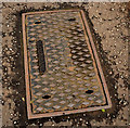
Blakeborough access cover, Lisburn
A Blakeborough http://www.geograph.org.uk/search.php?i=24358696 air valve cover, on the Moira Road, near Hull’s Lane.
Image: © Albert Bridge Taken: 28 Aug 2011
0.12 miles
8
Train, Knockmore, Lisburn
A four-car “80” class set (88, 766, 732, 81), working the 08.00 Londonderry – Belfast Central, approaching the site of the former Knockmore Jct Image The level crossing and junction had been replaced by the third line to Lisburn Image and Image but the old alignment was still marked by a short stretch of concrete sleepers (middle). The yellow stickers read “Citytrack” – a name then used for marketing and advertising “Take the easy way there, take the easy way back, take your local Citytrack”. Image shows a more recent view (August 2011). The Google map shows a non-existent station called “Knockmore”.
Image: © Albert Bridge Taken: 10 May 1980
0.13 miles
9
Pylon and power lines, Lisburn (2)
See Image A pylon and power lines, in the midst of commercial premises, opposite Flush Park, close to the Knockmore Road Image The line continues to Image
Image: © Albert Bridge Taken: 28 Aug 2011
0.14 miles
10
Train, Knockmore, Lisburn (July 2014)
The 10.45 Portadown – Bangor (3016) approaching the site of the former Knockmore Jct. The proposed park and ride station would be served by these trains.
Image: © Albert Bridge Taken: 31 Jul 2014
0.14 miles
  • ...