
IMAGES TAKEN NEAR TO
Gortmore Park, LISBURN, BT28 2BW
Introduction
This page details the photographs taken nearby to Gortmore Park, BT28 2BW by members of the Geograph project.
The Geograph project started in 2005 with the aim of publishing, organising and preserving representative images for every square kilometre of Great Britain, Ireland and the Isle of Man.

There are currently over 7.5m images from over14,400 individuals and you can help contribute to the project by visiting https://www.geograph.org.uk
Image Map
Images are licensed for reuse under creativecommons.org/licenses/by-sa/2.0
Notes
- Clicking on the map will re-center to the selected point.
- The higher the marker number, the further away the image location is from the centre of the postcode.
Image Listing (35 Images Found)
Images are licensed for reuse under creativecommons.org/licenses/by-sa/2.0
Image
Details
Distance
1
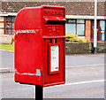
Letter box, Lisburn
Post-mounted EIIR letter box on the Causeway End Road, near the Independent Methodist Church.
Image: © Albert Bridge
Taken: 13 Mar 2011
0.09 miles
2
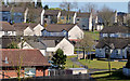
Iniscarn, Lisburn
Social housing between the Ballinderry Road (behind me) and the Causeway End Road.
Image: © Albert Bridge
Taken: 14 Apr 2013
0.09 miles
3
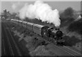
461 at Knockmore Halt
Preserved former DSER 2.6.0 No. 461 pulls away from the now closed Knockmore Halt as it approaches Lisburn on the currently "mothballed" line from Antrim.
Image: © The Carlisle Kid
Taken: 17 Feb 1991
0.14 miles
4
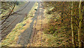
The third line, Lisburn (3)
The “mothballed” third line, looking towards Antrim, from the Causeway End Road bridge. There are more weeds on the track than in this view Image (October 2010).
Image: © Albert Bridge
Taken: 2 Dec 2012
0.15 miles
5
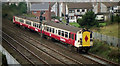
The Third Line, Lisburn
The third (single) line between Knockmore Jct Image and Lisburn Image finally opened in 1977. Someone noticed that it had been built without planning permission. A retrospective application followed. Permission was eventually given with the condition that a sound barrier be provided. The 11.35 Ballymena – Belfast Central is approaching the Causeway End Road bridge west of Lisburn station. See also Image
Image: © Albert Bridge
Taken: 11 Nov 1991
0.15 miles
6
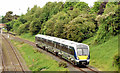
Diverted train, Knockmore, Lisburn - June 2014(1)
The railway was closed today between Belfast Central and Whiteabbey. Larne line passengers used a substitute bus between the two stations. Londonderry line trains were diverted via the mothballed Lisburn –Antrim line. C4K set 4002 has just passed the former Knockmore station Image and is climbing towards the Causeway End Road bridge with the 07.55 Coleraine – Belfast Central. This one Image (May 1982) makes an interesting comparison between the rolling stock and the growth of the lineside vegetation. Continue to Image
Image: © Albert Bridge
Taken: 1 Jun 2014
0.15 miles
7
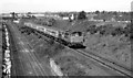
DL, Knockmore, Lisburn (1982)
103 “Merlin” on the third line, between Knockmore and the Causeway End Road bridge, with the 08.00 Londonderry – Belfast Central. See Image for a comparison 32 years later.
Image: © Albert Bridge
Taken: 29 May 1982
0.15 miles
8
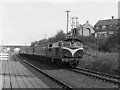
Train passing Knockmore halt
One of NIR's 101 class diesel locomotive hauls the afternoon Belfast - Dublin express passenger train past Knockmore halt. The wooded platform was a temporary structure built in 1974 to provide Knockmore with a train service pending completion of a direct railway line from Lisburn to Knockmore Junction. See also: Image
Image: © The Carlisle Kid
Taken: Unknown
0.15 miles
10
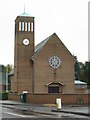
St Paul's Parish church Lisburn
This Church was consecrated in 1964.
Image: © Brian Shaw
Taken: 3 Nov 2005
0.16 miles