IMAGES TAKEN NEAR TO
Belvoir Park, LISBURN, BT28 1TZ

Introduction

This page details the photographs taken nearby to Belvoir Park, BT28 1TZ by members of the Geograph project.

The Geograph project started in 2005 with the aim of publishing, organising and preserving representative images for every square kilometre of Great Britain, Ireland and the Isle of Man.

There are currently over 7.5m images from over14,400 individuals and you can help contribute to the project by visiting https://www.geograph.org.uk

Image Map


Images are licensed for reuse under creativecommons.org/licenses/by-sa/2.0
Notes
  • Clicking on the map will re-center to the selected point.
  • The higher the marker number, the further away the image location is from the centre of the postcode.

Image Listing (28 Images Found)

Images are licensed for reuse under creativecommons.org/licenses/by-sa/2.0
  • ...
Image
Details
Distance
1
Belvoir Park, Lisburn
Two terraces, on the southern side of and parallel to Longstone Street, well screened by mature trees.
Image: © Albert Bridge Taken: 6 Aug 2009
0.00 miles
2
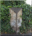
Milepost, Lisburn (2)
See Image Not in as good condition as the previous, this one is at Longstone Street/Belvoir Crescent (“Belvoir Mews” on the Google map) on the road to Moira. Mileposts of this design are thought to have been erected in the mid-19th century by the local Grand Jury. At the time this was the main road to Cos Armagh, Tyrone, Fermanagh and points beyond. Now replaced by the M1 Image
Image: © Albert Bridge Taken: 11 Jan 2009
0.02 miles
3
Vacant houses, Lisburn (4)
See Image The second of the two semis seen in the previous photo (Moira side). Image shows the house in August 2011.
Image: © Albert Bridge Taken: 19 Oct 2010
0.02 miles
4
Vacant houses, Lisburn (6)
See Image Ten months later, the house, on the Longstone, is roofless, fire damaged and a bit more overgrown.
Image: © Albert Bridge Taken: 14 Aug 2011
0.02 miles
5
Vacant houses, Lisburn (3)
See Image One of two semis beside the previous houses (Moira side) – also (presumably) awaiting an improvement in the property market. Continue to Image
Image: © Albert Bridge Taken: 19 Oct 2010
0.03 miles
6
The Longstone site, Lisburn (2012-2)
The eastern end of the site, from the other side of Longstone Street, showing the “sold” sign on the agents’ board.
Image: © Albert Bridge Taken: 2 Dec 2012
0.03 miles
7
Vacant houses, Lisburn
Two vacant semis, in Longstone Street awaiting demolition and redevelopment. Continue to Image
Image: © Albert Bridge Taken: 6 Aug 2009
0.03 miles
8
Vacant houses, Lisburn (2)
See Image 14 months later and the houses remain vacant and (presumably) awaiting an improvement in the property market, before demolition and redevelopemnt. Image shows the houses in August 2011.
Image: © Albert Bridge Taken: 19 Oct 2010
0.03 miles
9
Vacant house, Lisburn (7)
See Image Ten months later, the house, on the Longstone is a bit more overgrown but otherwise looking sound.
Image: © Albert Bridge Taken: 14 Aug 2011
0.03 miles
10
Milepost, Lisburn
Old milepost on the A3 at Lisburn. It records that Belfast is 9 miles away, Moira 8 miles and the centre of Lisburn 3/4 of a mile.
Image: © Rossographer Taken: 17 Jul 2022
0.04 miles
  • ...