
IMAGES TAKEN NEAR TO
Dundrod Court, LISBURN, BT28 1NF
Introduction
This page details the photographs taken nearby to Dundrod Court, BT28 1NF by members of the Geograph project.
The Geograph project started in 2005 with the aim of publishing, organising and preserving representative images for every square kilometre of Great Britain, Ireland and the Isle of Man.

There are currently over 7.5m images from over14,400 individuals and you can help contribute to the project by visiting https://www.geograph.org.uk
Image Map
Images are licensed for reuse under creativecommons.org/licenses/by-sa/2.0
Notes
- Clicking on the map will re-center to the selected point.
- The higher the marker number, the further away the image location is from the centre of the postcode.
Image Listing (23 Images Found)
Images are licensed for reuse under creativecommons.org/licenses/by-sa/2.0
Image
Details
Distance
1
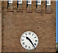
Clock, St Paul's, Lisburn
The clock (accurate), on St Paul’s (CoI) church Image, at the apex of the Moira and Ballinderry Roads.
Image: © Albert Bridge
Taken: 14 Apr 2013
0.08 miles
2
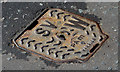
PAM stop valve cover, Lisburn
One of three PAM “Warrior” stop valve covers at the Ballinderry Road end of the Causeway End Road.
Image: © Albert Bridge
Taken: 14 Apr 2013
0.09 miles
3
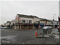
Longstone Street
Shops on Longstone Street to the west of Lisburn.
Image: © Robert Ashby
Taken: 25 Sep 2013
0.12 miles
4
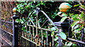
Old gate, Lisburn
A long-disused gate on the Ballinderry Road.
Image: © Albert Bridge
Taken: 13 Mar 2011
0.14 miles
5
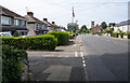
The A3, Lisburn
The A3 at Lisburn looking towards Moira. An old milepost seen in Image is on the bottom left of picture.
Image: © Rossographer
Taken: 17 Jul 2022
0.14 miles
6
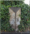
Milepost, Lisburn
Old milepost on the A3 at Lisburn. It records that Belfast is 9 miles away, Moira 8 miles and the centre of Lisburn 3/4 of a mile.
Image: © Rossographer
Taken: 17 Jul 2022
0.16 miles
7
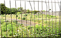
The Longstone site, Lisburn (May 2014)
This site, at Longstone Street, remains vacant awaiting development.
Image: © Albert Bridge
Taken: 18 May 2014
0.16 miles
8
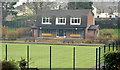
Bowling green, Lisburn
The bowling green, used by Lisnagarvey Bowling Club, in the Sir Milne Barbour Park.
Image: © Albert Bridge
Taken: 2 Dec 2012
0.16 miles
9
Milepost, Lisburn (2)
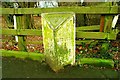
See Image Not in as good condition as the previous, this one is at Longstone Street/Belvoir Crescent (“Belvoir Mews” on the Google map) on the road to Moira. Mileposts of this design are thought to have been erected in the mid-19th century by the local Grand Jury. At the time this was the main road to Cos Armagh, Tyrone, Fermanagh and points beyond. Now replaced by the M1 Image
Image: © Albert Bridge
Taken: 11 Jan 2009
0.16 miles
10
The Longstone site, Lisburn (2012-1)
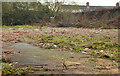
The vacant and derelict houses on this site (see the earlier photographs in this shared description) had become an eyesore and the scene of local nuisance. The council was unable to enforce its demolition order following the insolvency of the owner. Now sold and demolished (July 2012) by agreement with the new owner.
Image: © Albert Bridge
Taken: 2 Dec 2012
0.17 miles