
IMAGES TAKEN NEAR TO
Manor Park, LISBURN, BT28 1EY
Introduction
This page details the photographs taken nearby to Manor Park, BT28 1EY by members of the Geograph project.
The Geograph project started in 2005 with the aim of publishing, organising and preserving representative images for every square kilometre of Great Britain, Ireland and the Isle of Man.

There are currently over 7.5m images from over14,400 individuals and you can help contribute to the project by visiting https://www.geograph.org.uk
Image Map
Images are licensed for reuse under creativecommons.org/licenses/by-sa/2.0
Notes
- Clicking on the map will re-center to the selected point.
- The higher the marker number, the further away the image location is from the centre of the postcode.
Image Listing (24 Images Found)
Images are licensed for reuse under creativecommons.org/licenses/by-sa/2.0
Image
Details
Distance
1
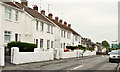
Warren Park Gardens, Lisburn
The Warren Gardens end of a street running from Warren Park. The name comes from the townland – Old Warren.
Image: © Albert Bridge
Taken: 19 May 2013
0.12 miles
2
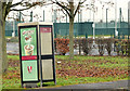
Telephone box, Lisburn
A leaning telephone box at Beechland Drive, Warren Park.
Image: © Albert Bridge
Taken: 2 Dec 2012
0.18 miles
3
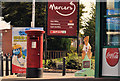
Pillar box, Lisburn
EIIR pillar box outside the post office in Longstone Street.
Image: © Albert Bridge
Taken: 14 Aug 2011
0.19 miles
4

Minibus, Lisburn
A Mercedes Vario minibus, of A1 Coach Travel, in the Leisureplex car park on the Governor’s Road.
Image: © Albert Bridge
Taken: 11 Jan 2009
0.19 miles
5
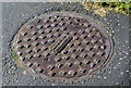
"Mallon's" manhole cover, Lisburn (2013-1)
See Image Another Mallons cover, to a different design, at the Longstone Street end of the Governor’s Road.
Image: © Albert Bridge
Taken: 14 Apr 2013
0.19 miles
6
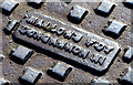
"Mallons" manhole cover, Lisburn (2013-2)
See Image The inscription “MALLON’S FDY DUNGANNON NI”.
Image: © Albert Bridge
Taken: 14 Apr 2013
0.19 miles
7
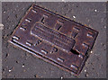
Blakeborough fire hydrant cover, Lisburn
A Lisburn Water Works fire hydrant cover, close to Warren Gardens, at Longstone Street. Cast by the Blakeborough foundry, Brighouse.
Image: © Albert Bridge
Taken: 14 Aug 2011
0.20 miles
8
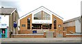
Lisburn Baptist Church
The present church, in Longstone Street, opened in 1977 replacing one in nearby Tonagh Avenue.
Image: © Albert Bridge
Taken: 6 Aug 2009
0.20 miles
9
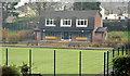
Bowling green, Lisburn
The bowling green, used by Lisnagarvey Bowling Club, in the Sir Milne Barbour Park.
Image: © Albert Bridge
Taken: 2 Dec 2012
0.20 miles
10
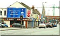
Longstone Street, Lisburn
Longstone Street (commonly “The Longstone”) is the continuation of the Moira Road into the centre of Lisburn. It has managed to retain a variety of shops to serve local residents (the Tonagh and Old Warren estates are nearby).
Image: © Albert Bridge
Taken: 11 Jan 2009
0.20 miles