
IMAGES TAKEN NEAR TO
The Green, LISBURN, BT28 1DX
Introduction
This page details the photographs taken nearby to The Green, BT28 1DX by members of the Geograph project.
The Geograph project started in 2005 with the aim of publishing, organising and preserving representative images for every square kilometre of Great Britain, Ireland and the Isle of Man.

There are currently over 7.5m images from over14,400 individuals and you can help contribute to the project by visiting https://www.geograph.org.uk
Image Map
Images are licensed for reuse under creativecommons.org/licenses/by-sa/2.0
Notes
- Clicking on the map will re-center to the selected point.
- The higher the marker number, the further away the image location is from the centre of the postcode.
Image Listing (41 Images Found)
Images are licensed for reuse under creativecommons.org/licenses/by-sa/2.0
Image
Details
Distance
1
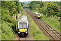
Diverted train, Knockmore, Lisburn - June 2014(3)
See Image The 09.25 Belfast Central – Londonderry (4014) climbing the third line towards the Causeway End Road bridge. 4020 is on the right with the 08.55 Bangor – Portadown. For the record the diversion, with a longer speed-restricted route and some extra waiting time at stations, adds 47 minutes to the journey.
Image: © Albert Bridge
Taken: 1 Jun 2014
0.10 miles
2
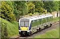
Diverted train, Knockmore, Lisburn - June 2014(2)
See Image The same train, on the other side of the Causeway End Road bridge, as it descends the third line towards Lisburn station. Continue to Image
Image: © Albert Bridge
Taken: 1 Jun 2014
0.10 miles
3
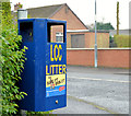
Doggy bin, Lisburn
A bin, for dog dirt, at the Benson Street end of Mountainvale Park. “LCC” is Lisburn City Council and not the long-departed London County Council. The street is shown but not named on the Google map.
Image: © Albert Bridge
Taken: 2 Dec 2012
0.11 miles
4
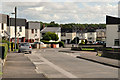
Slemish Way, Lisburn
Slemish Way, part of the Tonagh estate, seen from near the Causeway End Road.
Image: © Albert Bridge
Taken: 14 Aug 2011
0.12 miles
5
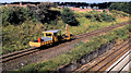
Railway hedgecutter, Lisburn
This machine, seen running towards Lisburn along the third line at the Causeway End Road, was (as I recall) a conversion from a permanent-way maintenance vehicle. It was used to trim lineside vegetation.
Image: © Albert Bridge
Taken: 11 Aug 1984
0.14 miles
6
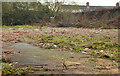
The Longstone site, Lisburn (2012-1)
The vacant and derelict houses on this site (see the earlier photographs in this shared description) had become an eyesore and the scene of local nuisance. The council was unable to enforce its demolition order following the insolvency of the owner. Now sold and demolished (July 2012) by agreement with the new owner.
Image: © Albert Bridge
Taken: 2 Dec 2012
0.14 miles
7
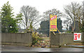
The Longstone site, Lisburn (2012-2)
The eastern end of the site, from the other side of Longstone Street, showing the “sold” sign on the agents’ board.
Image: © Albert Bridge
Taken: 2 Dec 2012
0.15 miles
8
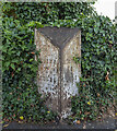
Milepost, Lisburn
Old milepost on the A3 at Lisburn. It records that Belfast is 9 miles away, Moira 8 miles and the centre of Lisburn 3/4 of a mile.
Image: © Rossographer
Taken: 17 Jul 2022
0.15 miles
9
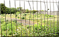
The Longstone site, Lisburn (May 2014)
This site, at Longstone Street, remains vacant awaiting development.
Image: © Albert Bridge
Taken: 18 May 2014
0.15 miles
10
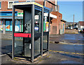
Telephone boxes, Lisburn (2013-1)
Two telephone boxes outside the shops at the corner of Longstone Street and Tonagh Drive.
Image: © Albert Bridge
Taken: 14 Apr 2013
0.16 miles