
IMAGES TAKEN NEAR TO
Rivergate Lane, LISBURN, BT27 5UG
Introduction
This page details the photographs taken nearby to Rivergate Lane, BT27 5UG by members of the Geograph project.
The Geograph project started in 2005 with the aim of publishing, organising and preserving representative images for every square kilometre of Great Britain, Ireland and the Isle of Man.

There are currently over 7.5m images from over14,400 individuals and you can help contribute to the project by visiting https://www.geograph.org.uk
Image Map
Images are licensed for reuse under creativecommons.org/licenses/by-sa/2.0
Notes
- Clicking on the map will re-center to the selected point.
- The higher the marker number, the further away the image location is from the centre of the postcode.
Image Listing (27 Images Found)
Images are licensed for reuse under creativecommons.org/licenses/by-sa/2.0
Image
Details
Distance
1
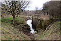
Canal locks
The recently uncovered Union Locks on the Lagan canal at Lisburn. Although I have passed this spot many times, owing to the dense undergrowth around the locks I was never aware of their existence. This was the only example of a four step lock in Ireland. No doubt they are due for renovation at sometime in the future.
Image: © Robert Ashby
Taken: 18 Feb 2015
0.04 miles
2
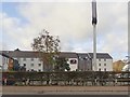
The Premier Inn, Lisburn
This is located on the A1 close to the junction with the M1.
Image: © Eric Jones
Taken: 25 Oct 2017
0.08 miles
3
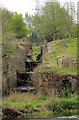
Lagan canal
The recently uncovered Union Locks, the only set of four step locks in Ireland.
Image: © Robert Ashby
Taken: 29 Apr 2015
0.08 miles
4
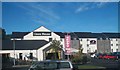
Linen House Restaurant and Premier Inn, Hillsborough Road
Image: © Eric Jones
Taken: 12 Oct 2012
0.09 miles
5
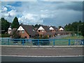
Blaris Court, Lisburn
This view is taken from the M1.
Image: © Eric Jones
Taken: 26 Aug 2011
0.10 miles
6
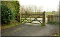
The Lagan towpath, Lisburn (5)
See Image The lagan towpath ends at this gate leading to the Blaris Road. The embankment in the background carries the M1 - built on the course of the canal as far as Moira.
Image: © Albert Bridge
Taken: 2 Apr 2008
0.10 miles
8
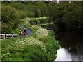
The Lagan path at Lisburn
The off-road cycle route along the River Lagan from Belfast to Lisburn ends at the Blaris Road just past the Union Locks bridge which the cyclists are approaching. This is part of the National Cycle Network's Route 93, a long distance route across Northern Ireland between Belfast and Ballyshannon in Co Donegal.
Image: © Robert Ashby
Taken: 4 Jun 2005
0.12 miles
9
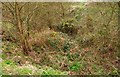
Disused lock near Lisburn (3)
See Image The view towards Lough Neagh (not shown on the Google map).
Image: © Albert Bridge
Taken: 2 Apr 2008
0.12 miles
10
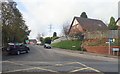
Blaris Road at its junction with the A1
This road leads to Blaris Cemetery.
Image: © Eric Jones
Taken: 25 Oct 2017
0.13 miles