IMAGES TAKEN NEAR TO
Kensington Close, LISBURN, BT27 5NL

Introduction

This page details the photographs taken nearby to Kensington Close, BT27 5NL by members of the Geograph project.

The Geograph project started in 2005 with the aim of publishing, organising and preserving representative images for every square kilometre of Great Britain, Ireland and the Isle of Man.

There are currently over 7.5m images from over14,400 individuals and you can help contribute to the project by visiting https://www.geograph.org.uk

Image Map


Images are licensed for reuse under creativecommons.org/licenses/by-sa/2.0
Notes
  • Clicking on the map will re-center to the selected point.
  • The higher the marker number, the further away the image location is from the centre of the postcode.

Image Listing (40 Images Found)

Images are licensed for reuse under creativecommons.org/licenses/by-sa/2.0
  • ...
Image
Details
Distance
1
The Ballynahinch Road, Lisburn
The mainly residential Ballynahinch Road looking outwards. The M1 passes beyond the street lights in the background and marks the end of Lisburn, in this direction, on the Co Down side of the Lagan. It sprawls to a greater extent, however, on the Co Antrim side.
Image: © Albert Bridge Taken: 18 Feb 2009
0.03 miles
2
Development site, Lisburn
A now vacant site, previously a detached house. Taken with the one on the left Image they have great potential for thousands of apartments.
Image: © Albert Bridge Taken: 28 Apr 2010
0.04 miles
3
Sprucefield Orange Hall
This small pebble-dashed hall was built in 1929.
Image: © Brian Shaw Taken: 9 Nov 2005
0.04 miles
4
Warehouse
Typical of the type of building in the modern Altona Industrial Estate outside Lisburn.
Image: © Brian Shaw Taken: 9 Nov 2005
0.04 miles
5
Pillar box, Lisburn
EIIR pillar box at Kensington Park off the Ballynahinch Road (background). It can be seen, in its setting, on the left in Image
Image: © Albert Bridge Taken: 4 Dec 2011
0.04 miles
6
Kensington Park, Lisburn
Semi-detached houses off the Ballynahinch Road.
Image: © Albert Bridge Taken: 24 Aug 2010
0.05 miles
7
Houses in Wynford Park, Lisburn
These houses back on to the M1.
Image: © Eric Jones Taken: 4 Jun 2016
0.05 miles
8
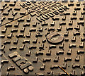
NTL/Hudson access cover, Lisburn (2)
See Image The NTL logo and the maker’s name.
Image: © Albert Bridge Taken: 4 Dec 2011
0.05 miles
9
NTL/Hudson access cover, Lisburn (1)
NTL access cover, beside a relay box, on the Ballynahinch Road. It carries the name “Hudson” but I can’t find any references to a (reasonably) recent British foundry of that name. Further information welcome. Image shows the NTL logo and the maker’s name.
Image: © Albert Bridge Taken: 4 Dec 2011
0.05 miles
10
Vacant house, Lisburn (3)
A vacant (and well fenced) chalet bungalow on the Ballynahinch Road (almost opposite Landor Park). Taken with the adjacent site Image it has great potential for thousands of apartments.
Image: © Albert Bridge Taken: 28 Apr 2010
0.05 miles
  • ...