IMAGES TAKEN NEAR TO
Castle Street, LISBURN, BT27 4DH

Introduction

This page details the photographs taken nearby to Castle Street, BT27 4DH by members of the Geograph project.

The Geograph project started in 2005 with the aim of publishing, organising and preserving representative images for every square kilometre of Great Britain, Ireland and the Isle of Man.

There are currently over 7.5m images from over14,400 individuals and you can help contribute to the project by visiting https://www.geograph.org.uk

Image Map


Images are licensed for reuse under creativecommons.org/licenses/by-sa/2.0
Notes
  • Clicking on the map will re-center to the selected point.
  • The higher the marker number, the further away the image location is from the centre of the postcode.

Image Listing (448 Images Found)

Images are licensed for reuse under creativecommons.org/licenses/by-sa/2.0
  • ...
Image
Details
Distance
1
South Eastern Regional College, Lisburn Campus
Pictured are the old and new wings
Image: © Kenneth Allen Taken: 4 Jul 2008
0.00 miles
2
War Memorial, Lisburn
Looking south
Image: © Kenneth Allen Taken: 4 Jul 2008
0.00 miles
3
Former Town Hall, Lisburn
The former Wallace estate office Image, in Castle Street, was built in 1883. It became the Town Hall and remained so until 2001.
Image: © Albert Bridge Taken: 31 Oct 2007
0.01 miles
4
Boot scraper, Lisburn (2)
See Image Another boot scraper, almost just around the corner, on this building Image in Castle Street.
Image: © Albert Bridge Taken: 19 May 2013
0.01 miles
5
Manhole cover, Lisburn
A manhole cover, in Castle Street, bearing the name of JP Corry, building suppliers, Belfast.
Image: © Albert Bridge Taken: 15 Aug 2010
0.01 miles
6
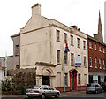
No 36 Castle Street, Lisburn (1)
No 34 Castle Street previously seen in Image – a long-time vacant property now with an agent’s board advertising it “For sale with planning permission for change of use to retail and offices”. Listed as HB19/16/005 and on the “at risk” register where it is described as “The UAHS list of 1969 in the then Borough of Lisburn referred to the old Masonic Hall as a “three-storey, five-bay building, rendered fairly recently, with Ionic porch and pediment and extremely good cast iron fanlight”. The description went on to suggest that the building was “in grave “danger” , presumably due to the uncertainty surrounding its future as it was for sale. Almost forty years later the building is again faced with the unknown, being vacant, and having recently suffered fire damage. However, unlike the late-1960s, it is now afforded statutory protection, both through listing, and also within the Lisburn Conservation Area, designated in 1992. It is a building of tremendous character and an important frame for the neighbouring Castle Gardens. Refs: UAHS, Lisburn, 1969, p.11 ”. Whether it is to be demolished or restored remains a mystery. The Google map and the satellite photo are a bit out of alignment. Continue to Image
Image: © Albert Bridge Taken: 2 Jan 2011
0.01 miles
7
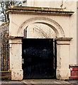
No 36 Castle Street, Lisburn (2)
See Image The gateway leading to what was once the garden. Continue to Image
Image: © Albert Bridge Taken: 2 Jan 2011
0.01 miles
8
No 36 Castle Street, Lisburn (5)
See Image (January 2011). The former Masonic Hall is now being restored. Continue to Image (September 2012).
Image: © Albert Bridge Taken: 8 Apr 2012
0.01 miles
9
Serpent, Lisburn
This serpent sits over a gateway in Castle Street.
Image: © Albert Bridge Taken: 15 Aug 2010
0.02 miles
10
The Wallace House, Lisburn (2)
Listed as HB19/13/004. Built in 1880 for Sir Richard Wallace and bought, by the council, in 1914 for use as a technical school. The architect might have been William McHenry who also designed the (now demolished) Lisburn courthouse. Still in educational use.
Image: © Albert Bridge Taken: 21 Aug 2011
0.02 miles
  • ...