
IMAGES TAKEN NEAR TO
Belsize Road, LISBURN, BT27 4BN
Introduction
This page details the photographs taken nearby to Belsize Road, BT27 4BN by members of the Geograph project.
The Geograph project started in 2005 with the aim of publishing, organising and preserving representative images for every square kilometre of Great Britain, Ireland and the Isle of Man.

There are currently over 7.5m images from over14,400 individuals and you can help contribute to the project by visiting https://www.geograph.org.uk
Image Map
Images are licensed for reuse under creativecommons.org/licenses/by-sa/2.0
Notes
- Clicking on the map will re-center to the selected point.
- The higher the marker number, the further away the image location is from the centre of the postcode.
Image Listing (17 Images Found)
Images are licensed for reuse under creativecommons.org/licenses/by-sa/2.0
Image
Details
Distance
1
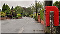
Letter box, Lisburn
Post-mounted EIIR letter box on the Belsize Road, opposite Harmony Hill.
Image: © Albert Bridge
Taken: 17 Jul 2011
0.04 miles
2
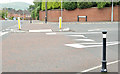
Harmony Hill, Lisburn
The Belsize Road end.
Image: © Albert Bridge
Taken: 5 Jul 2013
0.04 miles
3
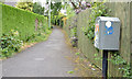
Drop box, Lisburn
A drop box at the Harmony Hill end of this lane Image
Image: © Albert Bridge
Taken: 5 Jul 2013
0.09 miles
4
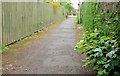
Lane, Lisburn
The Harmony Hill end of a lane from Richmond Court.
Image: © Albert Bridge
Taken: 5 Jul 2013
0.09 miles
5
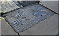
NTL access cover, Lisburn (1)
NTL provided a telephone, cable television and internet service – part of Virgin Media since 2006. This Brickhouse cover is on the Belfast Road, opposite Garvey Manor. Image shows the logo and foundry name.
Image: © Albert Bridge
Taken: 13 Jul 2011
0.19 miles
6
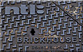
NTL access cover, Lisburn (2)
See Image The NTL logo and the foundry name.
Image: © Albert Bridge
Taken: 13 Jul 2011
0.19 miles
7
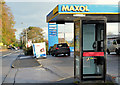
Telephone box, Hilden/Lisburn
BT telephone box, at the Maxol/Spar, on the Belfast Road.
Image: © Albert Bridge
Taken: 5 Nov 2012
0.19 miles
8
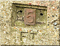
Old gas main marker post, Lisburn (2)
See Image A close look at the post showing how numbers could be inserted to show the appropriate distance to the main.
Image: © Albert Bridge
Taken: 5 Jul 2013
0.20 miles
9
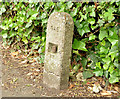
Old gas main marker post, Lisburn (1)
An old concrete post, on the eastern side of Harmony Hill, near Riverside Drive, marking the site of a town gas main. To the best of my knowledge Lisburn produced town gas from the late 1830’s to 1981. Image is a close look at the inscription.
Image: © Albert Bridge
Taken: 5 Jul 2013
0.20 miles
10
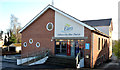
Lisburn Elim church
Formerly in Wallace Avenue, the present church, on the Belfast Road (acquired, in a partly-completed state, from another church) opened in 1984.
Image: © Albert Bridge
Taken: 1 Dec 2012
0.20 miles