IMAGES TAKEN NEAR TO
Glebe Road, HILLSBOROUGH, BT26 6NE

Introduction

This page details the photographs taken nearby to Glebe Road, BT26 6NE by members of the Geograph project.

The Geograph project started in 2005 with the aim of publishing, organising and preserving representative images for every square kilometre of Great Britain, Ireland and the Isle of Man.

There are currently over 7.5m images from over14,400 individuals and you can help contribute to the project by visiting https://www.geograph.org.uk

Image Map


Images are licensed for reuse under creativecommons.org/licenses/by-sa/2.0
Notes
  • Clicking on the map will re-center to the selected point.
  • The higher the marker number, the further away the image location is from the centre of the postcode.

Image Listing (13 Images Found)

Images are licensed for reuse under creativecommons.org/licenses/by-sa/2.0
Image
Details
Distance
1
Church graveyard, Annahilt (1)
Something common to all old headstones – weathering making the inscription illegible.
Image: © Albert Bridge Taken: 19 Mar 2012
0.04 miles
2
Church graveyard, Annahilt (3)
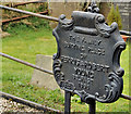
A cast-iron marker, made by the Musgrave Foundry, Belfast Image, at the family burying ground of Francis Crothers. Image shows the maker’s name.
Image: © Albert Bridge Taken: 19 Mar 2012
0.05 miles
3
Church graveyard, Annahilt (4)
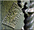
The maker’s name, Musgrave & Co, Belfast, on the back of this grave marker Image
Image: © Albert Bridge Taken: 19 Mar 2012
0.05 miles
4
Church graveyard, Annahilt (2)
One unusual feature of the graveyard at the Church of the Ascension is the survival of several cast-iron grave numbers.
Image: © Albert Bridge Taken: 19 Mar 2012
0.05 miles
5
Church graveyard, Annahilt (5)
A cast-iron marker, which seems to have been made by the Union Foundry, Belfast http://www.geograph.org.uk/search.php?i=29637732 at the family burying place of Ferris and Robert Young. The grave also includes a cast-iron grave number. Image shows the maker’s name.
Image: © Albert Bridge Taken: 19 Mar 2012
0.05 miles
6
Church graveyard, Annahilt (6)
The inscription on the back of this grave marker Image Covered by many layers of paint and seen from an awkward angle, it seems to refer to William Gregg, Sons & Phenix, the Union Foundry, Belfast http://www.geograph.org.uk/search.php?i=29637732.
Image: © Albert Bridge Taken: 19 Mar 2012
0.05 miles
7
The Church of the Ascension, Annahilt (3)
The bell.
Image: © Albert Bridge Taken: 19 Mar 2012
0.07 miles
8
The Church of the Ascension, Annahilt (1)
The church with part of the graveyard in the foreground. See also Image (October 2005) and Image (June 2009).
Image: © Albert Bridge Taken: 19 Mar 2012
0.08 miles
9
The Church of the Ascension, Annahilt (2)
The door and windows on the south western side of the church.
Image: © Albert Bridge Taken: 19 Mar 2012
0.08 miles
10
Church of the Ascension (C of I), Annahilt, Co Down
Image: © Dr Neil Clifton Taken: 28 Jun 2009
0.10 miles