IMAGES TAKEN NEAR TO
The Square, HILLSBOROUGH, BT26 6AG

Introduction

This page details the photographs taken nearby to The Square, BT26 6AG by members of the Geograph project.

The Geograph project started in 2005 with the aim of publishing, organising and preserving representative images for every square kilometre of Great Britain, Ireland and the Isle of Man.

There are currently over 7.5m images from over14,400 individuals and you can help contribute to the project by visiting https://www.geograph.org.uk

Image Map


Images are licensed for reuse under creativecommons.org/licenses/by-sa/2.0
Notes
  • Clicking on the map will re-center to the selected point.
  • The higher the marker number, the further away the image location is from the centre of the postcode.

Image Listing (452 Images Found)

Images are licensed for reuse under creativecommons.org/licenses/by-sa/2.0
  • ...
Image
Details
Distance
1
Datestone, Hillsborough
The date of building (1964) on the former offices of Hillsborough Rural District Council Image On reorganisation of local government the area became part of Lisburn and Castlereagh districts. See also Image
Image: © Albert Bridge Taken: 15 Jan 2011
0.00 miles
2
Balcony, Hillsborough
See Image The building also includes this balcony – topped by the old Council’s coat of arms.
Image: © Albert Bridge Taken: 15 Jan 2011
0.00 miles
3
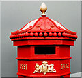
Victorian pillar box, Hillsborough (detail)
The detail, picked out in gold paint, on the “Penfold” pillar box Image at The Square. The grey background is the hoarding around the old council office Image
Image: © Albert Bridge Taken: 15 Jan 2011
0.00 miles
4
"Penfold" pillar box, Hillsborough
See Image (February 2007). This “Penfold” VR pillar box (BT26 64) is still standing at The Square, close to Hillsborough Castle. The Google map and the satellite photograph do not coincide.
Image: © Albert Bridge Taken: 30 Mar 2012
0.01 miles
5
Lantern, Hillsborough
An ornamental lantern, advertising an off-licence, at The Square. The Google map and the satellite photograph do not coincide.
Image: © Albert Bridge Taken: 30 Mar 2012
0.01 miles
6
Bench mark, Hillsborough
It is located on the front wall left-hand side of this building here Image] We used to take readings from these OS marks when taking levels, but I guess that they may be no longer important with the modern technology.
Image: © Kenneth Allen Taken: 25 Jan 2010
0.01 miles
7
Preserved army vehicle, Hillsborough
A preserved Humber “Pig” armoured personnel carrier (with civilian number plate), parked outside the tourist office in Hillsborough. They were once used by the army (and to a much lesser extent, the police) during “The Troubles”/”The Armed Struggle”.
Image: © Albert Bridge Taken: 6 Nov 2009
0.01 miles
8
Thompson Mitchell, Hillsborough
They overlook the square on the main street
Image: © Kenneth Allen Taken: 25 Jan 2010
0.01 miles
9
Hillsborough, The Fort
Built in 1650 by Colonel Arthur Hill.
Image: © Gordon Flanagan Taken: 4 Apr 2015
0.01 miles
10
Doors, Hillsborough
See Image A close look at the doors of nos 8 and 9 The Square. The buildings date from the late 18th century.
Image: © Albert Bridge Taken: 18 Jan 2009
0.01 miles
  • ...