IMAGES TAKEN NEAR TO
Church Hill Gardens, DROMORE, BT25 2NB
Introduction
This page details the photographs taken nearby to Church Hill Gardens, BT25 2NB by members of the Geograph project.
The Geograph project started in 2005 with the aim of publishing, organising and preserving representative images for every square kilometre of Great Britain, Ireland and the Isle of Man.

There are currently over 7.5m images from over14,400 individuals and you can help contribute to the project by visiting https://www.geograph.org.uk
Image Map
Images are licensed for reuse under creativecommons.org/licenses/by-sa/2.0
Notes
- Clicking on the map will re-center to the selected point.
- The higher the marker number, the further away the image location is from the centre of the postcode.
Image Listing (37 Images Found)
Images are licensed for reuse under creativecommons.org/licenses/by-sa/2.0
Image
Details
Distance
1
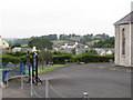
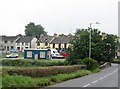
The Church Hill Gardens Estate viewed from Begny Hill
Church Hill Gardens are opposite St John's Church on the Dromore Road. In the foreground are the grounds of the Second Dromara Presbyterian Church.
Image: © Eric Jones
Taken: 29 Sep 2015
0.03 miles
2

"God welcomes all sorts"
This a Sunday School banner on the gable end of St John's Hall.
Image: © Eric Jones
Taken: 29 Sep 2015
0.04 miles
3
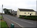
St John's Parish Hall, Dromore Street
The Church of St John the Evangelist can be seen in the background.
Image: © Eric Jones
Taken: 29 Sep 2015
0.04 miles
4
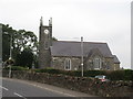
St John the Evangelist CoI Church, Dromara
Situated on the Banbridge Road, this Anglican Church built in 1811 occupies the former site of a Catholic church. People from both communities are buried in its churchyard.
Image: © Eric Jones
Taken: 29 Sep 2015
0.05 miles
5
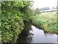
The Lagan upstream of the Dromore Street bridge
Image: © Eric Jones
Taken: 29 Sep 2015
0.06 miles
6
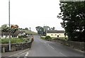
Leaving Dromara across the Lagan Bridge
The road, here known as Dromore Street leads towards Dromore and Portadown. The bus from Lisburn via Annahilt also uses this approach. The yellow building on the right is St John's Hall.
Image: © Eric Jones
Taken: 29 Sep 2015
0.07 miles
7
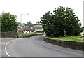
The Dromore Street bridge over the River Lagan
The road junction in the foreground is with Moybrick Road.
Image: © Eric Jones
Taken: 29 Sep 2015
0.08 miles
8
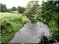
The River Lagan below the Dromore Street Bridge
The Lagan rises on Slieve Croob, some 8kms south-east of Dromara.
Image]
Image: © Eric Jones
Taken: 29 Sep 2015
0.08 miles
9
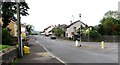
Moybrick Road, Dromara
The Moybrick Road runs west from the junction with Dromore Street close to the bridge over the Lagan.
Image: © Eric Jones
Taken: 29 Sep 2015
0.09 miles