
IMAGES TAKEN NEAR TO
Slievenaboley Road, DROMORE, BT25 2HP
Introduction
This page details the photographs taken nearby to Slievenaboley Road, BT25 2HP by members of the Geograph project.
The Geograph project started in 2005 with the aim of publishing, organising and preserving representative images for every square kilometre of Great Britain, Ireland and the Isle of Man.

There are currently over 7.5m images from over14,400 individuals and you can help contribute to the project by visiting https://www.geograph.org.uk
Image Map
Images are licensed for reuse under creativecommons.org/licenses/by-sa/2.0
Notes
- Clicking on the map will re-center to the selected point.
- The higher the marker number, the further away the image location is from the centre of the postcode.
Image Listing (6 Images Found)
Images are licensed for reuse under creativecommons.org/licenses/by-sa/2.0
Image
Details
Distance
1

Countryside near Finnis
The view, approximately to the SW, from close to Finnis souterrain Image, showing a landscape typical of the lower parts of the Dromara Hills.
Image: © Albert Bridge
Taken: 15 Jun 2008
0.10 miles
2

Path to Finnis souterrain
Image: © Albert Bridge
Taken: 15 Jun 2008
0.18 miles
3

The Carrigagh Road near Finnis
A narrow road running through the Dromara Hills close to Slievenaboley.
Image: © Albert Bridge
Taken: 15 Jun 2008
0.19 miles
4
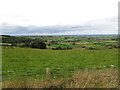
The northern slopes of Slievenaboley from the Windy Gap Pad
The view extends beyond towards the towns of the Lagan Valley.
Image: © Eric Jones
Taken: 15 Aug 2014
0.21 miles
5
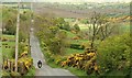
The Slievenaboley Road near Dromara
A minor road which, under more than one name, runs north west from Leitrim towards the Rathfriland – Dromara road.
Image: © Albert Bridge
Taken: 2 May 2009
0.24 miles
6

Farmland on the northern slopes of Slievenaboley Mountain
Image: © Eric Jones
Taken: 15 Aug 2014
0.25 miles