
IMAGES TAKEN NEAR TO
Demesne Valley, DROMORE, BT25 1TD
Introduction
This page details the photographs taken nearby to Demesne Valley, BT25 1TD by members of the Geograph project.
The Geograph project started in 2005 with the aim of publishing, organising and preserving representative images for every square kilometre of Great Britain, Ireland and the Isle of Man.

There are currently over 7.5m images from over14,400 individuals and you can help contribute to the project by visiting https://www.geograph.org.uk
Image Map
Images are licensed for reuse under creativecommons.org/licenses/by-sa/2.0
Notes
- Clicking on the map will re-center to the selected point.
- The higher the marker number, the further away the image location is from the centre of the postcode.
Image Listing (31 Images Found)
Images are licensed for reuse under creativecommons.org/licenses/by-sa/2.0
Image
Details
Distance
1

Demesne Valley, Dromore
Built around 2004 - Demesne Valley is a development off the Hillsborough Road in Dromore.
Image: © Dean Molyneaux
Taken: 16 Jul 2009
0.01 miles
2
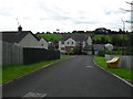
Demesne Valley, Dromore
Built around 2004 - Demesne Valley is a development off the Hillsborough Road in Dromore.
Image: © Dean Molyneaux
Taken: 16 Jul 2009
0.03 miles
3
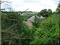
Mossvale House, Dromore
Mossvale House is a private dwelling set amongst trees - accessed from Dromore's Hillsborough Road. It is seen here from Demesne Valley.
Image: © Dean Molyneaux
Taken: 16 Jul 2009
0.05 miles
4
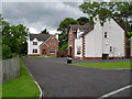
Demesne Valley, Dromore (2)
Built around 2004 - Demesne Valley is a development off the Hillsborough Road in Dromore.
Image: © Dean Molyneaux
Taken: 16 Jul 2009
0.06 miles
5
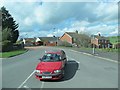
Jubilee Road, Dromore, at its junction with the B2
Image: © Eric Jones
Taken: 2 Apr 2011
0.08 miles
6
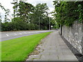
Hillsborough Road at Demesne Valley, Dromore
The Hillsborough Road at Demesne Valley in Dromore.
Image: © Dean Molyneaux
Taken: 16 Jul 2009
0.09 miles
7
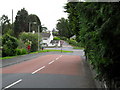
The Dandy Caps, Dromore
The junction - formerly a crossroads - where the Ballymacormick and Jubilee Roads meet the Hillsborough Road is known locally as the 'Dandy Caps'. A historical journal written by a local historian - the late Andrew Doloughan - claims that there was once a lady who lived there who made things called 'dandy caps'.
Image: © Dean Molyneaux
Taken: 16 Jul 2009
0.09 miles
8
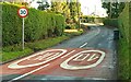
Road markings, Dromore
The view, from the Hillsborough Road, outward along the Ballymacormick Road showing the speed limits on the two roads. The Ballymacormick Road is not as rural as it appears. Recent development is hidden by the bend.
Image: © Albert Bridge
Taken: 22 Jan 2009
0.10 miles
9
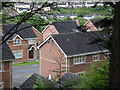
Bracken Valley, Dromore
Bracken Valley is a newer extension of the existing development - Bracken Valley.
Image: © Dean Molyneaux
Taken: 16 Jul 2009
0.10 miles
10

Laneway at Mossvale
This laneway in theory stretches up to the Hillsborough Road - however this is a private house halfway up the hill therefore it is not a right of way. This ground was earmarked as the likely site of a new primary school.
Image: © Dean Molyneaux
Taken: 18 Jul 2009
0.12 miles