
IMAGES TAKEN NEAR TO
Castle Mills, DROMORE, BT25 1FJ
Introduction
This page details the photographs taken nearby to Castle Mills, BT25 1FJ by members of the Geograph project.
The Geograph project started in 2005 with the aim of publishing, organising and preserving representative images for every square kilometre of Great Britain, Ireland and the Isle of Man.

There are currently over 7.5m images from over14,400 individuals and you can help contribute to the project by visiting https://www.geograph.org.uk
Image Map
Images are licensed for reuse under creativecommons.org/licenses/by-sa/2.0
Notes
- Clicking on the map will re-center to the selected point.
- The higher the marker number, the further away the image location is from the centre of the postcode.
Image Listing (312 Images Found)
Images are licensed for reuse under creativecommons.org/licenses/by-sa/2.0
Image
Details
Distance
1
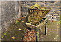
Old agricultural machine, Dromore (1)
A preserved piece of old (hand cranked) agricultural machinery (once used to pulp turnips) in Meeting Street. Image shows the maker’s name.
Image: © Albert Bridge
Taken: 23 Sep 2011
0.01 miles
2
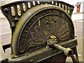
Old agricultural machine, Dromore (2)
See Image The inscription on the back – “Wexford Engineering Co Ltd New Star”. The rest is not legible.
Image: © Albert Bridge
Taken: 23 Sep 2011
0.01 miles
3
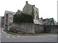
Buildings at the junction of Rampart Street and Meeting Street
The houses face on to Castle Street.
Image: © Eric Jones
Taken: 3 Apr 2017
0.01 miles
4
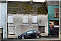
Nos 7-9 Rampart Street, Dromore
Two vacant and blocked-up former terrace houses at the Meeting Street end of Rampart Street. Offered for sale and described by the agent as “7 to 9 Rampart Street, Dromore gives prospective purchasers the opportunity to purchase a site in a convenient and popular location with full planning permission for two apartments, a ground floor one bedroom apartment and a duplex two bedroom apartment”. This photograph appears as a matter of record only. I have no connection with any of the parties involved in the sale.
Image: © Albert Bridge
Taken: 2 Nov 2012
0.01 miles
5
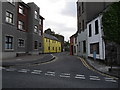
Castle Street, Dromore
Castle Street is a narrow thoroughfare between Rampart Street and the Banbridge Road. On it is sited the ruins of Dromore Castle. The apartment block on the left replaced a former factory in 2004.
Image: © Dean Molyneaux
Taken: 14 Jul 2009
0.02 miles
6
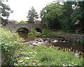
Bridge over the River Lagan at Dromore, Co. Down
Photograph taken from the grounds of Cromore Cathedral: for many years the main road from Belfast to Dublin used this bridge, prior to the construction of the town bypass.
Image: © paddy heron
Taken: Unknown
0.02 miles
7
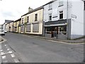
The junction of Rampart Street and Meeting Street, Dromore
Vacant shops are common in Dromore. The 2003 Dromore Town Centre Development Plan showed that some 25% of the town's two hundred outlets were vacant.
Image: © Eric Jones
Taken: 4 Apr 2017
0.02 miles
8
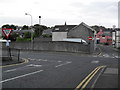
Junction of Rampart Street and Meeting Street
Until 1985, Rampart Street ran straight into Bridge Street (to left). The Woollen Hall building which stood in the centre of the photo was demolished to make way for a new extension to Meeting Street in order to alleviate congestion on Bridge Street.
Image: © Dean Molyneaux
Taken: 14 Jul 2009
0.02 miles
9
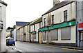
Nos 4&6 Meeting Street, Dromore
Two vacant and semi-derelict buildings at the Bridge Street end of Meeting Street. They seem to be nos 4 and 6.
Image: © Albert Bridge
Taken: 2 Nov 2012
0.03 miles
10

The towers of Dromore Castle from the corner of Meeting Street
This tower house was built for John Todd, a former Jesuit priest, who became the town's Anglican bishop in 1606. The construction was undertaken by William Worsley, Todd's brother-in-law. During the Catholic uprising of 1641 much of the town of Dromore including the cathedral was destroyed. The castle however survived.
Image: © Eric Jones
Taken: 3 Apr 2017
0.03 miles