1
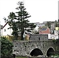
Dromore Castle, Castle Street, Dromore
This tower house was built for John Todd, a former Jesuit priest, who became the town's Anglican bishop in 1606. The construction was undertaken by William Worsley, Todd's brother-in-law. During the Catholic uprising of 1641 much of the town of Dromore including the cathedral was destroyed. The castle however survived.
Image: © Eric Jones
Taken: 3 Apr 2017
0.01 miles
2
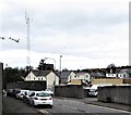
The Banbridge Road, Dromore
The Banbridge Road (looking towards Banbridge, from the corner of Meeting Street) showing houses below road level. Something similar can be seen in Downpatrick
Image and
Image
Image: © Albert Bridge
Taken: 23 Sep 2011
0.01 miles
3
"Goldline" coach, Dromore
An Ulsterbus Irizar-bodied Scania calling at the stop on the Banbridge Road with the 09.15 Newry – Belfast “Goldline” express. Goldline coaches, to Belfast, do not serve the Square. They run via the Lurgan Road joining the bypass at this flyover
Image
Image: © Albert Bridge
Taken: 25 Aug 2012
0.01 miles
4
Two Goldline coaches, Dromore (2013-2)
See
Image Both coaches at the express stop, opposite the police station, on the Banbridge Road.
Image: © Albert Bridge
Taken: 27 Jul 2013
0.01 miles
5
The mothballed Dromore Police Station
This is located at the southern end of the Regent Bridge.
Image: © Eric Jones
Taken: 3 Apr 2017
0.01 miles
6
Sweeping curves in Castle Street, Dromore
The ruins of Dromore Castle stand on the right.
Image: © Eric Jones
Taken: 4 Apr 2017
0.02 miles
7
View West along Castle Street, Dromore
The ruined tower house is visible at the bend.
Image: © Eric Jones
Taken: 3 Apr 2017
0.02 miles
8
Dromore PSNI Station viewed along Meeting Street
Image: © Eric Jones
Taken: 3 Apr 2017
0.02 miles
9
Girdled with steel - Dromore's PSNI Station
Blast screens surround this building on the banks of the Lagan. The image taken from the Downshire Bridge shows the rear of the station.
Image: © Eric Jones
Taken: 4 Apr 2017
0.02 miles
10
The towers of Dromore Castle from the corner of Meeting Street
This tower house was built for John Todd, a former Jesuit priest, who became the town's Anglican bishop in 1606. The construction was undertaken by William Worsley, Todd's brother-in-law. During the Catholic uprising of 1641 much of the town of Dromore including the cathedral was destroyed. The castle however survived.
Image: © Eric Jones
Taken: 3 Apr 2017
0.02 miles


