IMAGES TAKEN NEAR TO
Windmill Drive, BALLYNAHINCH, BT24 8WD

Introduction

This page details the photographs taken nearby to Windmill Drive, BT24 8WD by members of the Geograph project.

The Geograph project started in 2005 with the aim of publishing, organising and preserving representative images for every square kilometre of Great Britain, Ireland and the Isle of Man.

There are currently over 7.5m images from over14,400 individuals and you can help contribute to the project by visiting https://www.geograph.org.uk

Image Map


Images are licensed for reuse under creativecommons.org/licenses/by-sa/2.0
Notes
  • Clicking on the map will re-center to the selected point.
  • The higher the marker number, the further away the image location is from the centre of the postcode.

Image Listing (25 Images Found)

Images are licensed for reuse under creativecommons.org/licenses/by-sa/2.0
  • ...
Image
Details
Distance
1
Fields, Ballynahinch
Fields and drumlins approximately on the eastern edge of Ballynahinch - seen from Windmill Hill Image
Image: © Albert Bridge Taken: 27 Mar 2010
0.10 miles
2
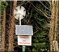
Wind turbine and solar panel, Ballynahinch
A solar panel and small wind turbine at St Colman’s High School, on the Crossgar Road.
Image: © Albert Bridge Taken: 3 Mar 2012
0.13 miles
3
Old railway, Ballynahinch (2)
Just about recognisable as the course of an old railway, this is the view, towards the former Ballynahinch station, from this bridge Image on the Crossgar Road. Given that side roads are usually affected by the building of a new road, this stretch of old railway might be removed to accommodate the proposed bypass.
Image: © Albert Bridge Taken: 3 Mar 2012
0.14 miles
4
Old railway bridge, Ballynahinch
Ballynahinch was the terminus of a short branch (3½ miles) from Ballynahinch Jct Image, between Saintfield and Crossgar. This bridge carried the Crossgar – Ballynahinch (background) road across the line. My understanding is that the proposed bypass will cross the road between here and the Ballylone Road Image (at the houses, upper left). Image shows the bridge, looking in the opposite direction, in March 2010.
Image: © Albert Bridge Taken: 3 Mar 2012
0.15 miles
5
The proposed Ballynahinch bypass (7)
See Image The view (approximately) southeast from the Crossgar Road, showing the drumlin country through which the road will (unfortunately) have to pass. The line of bushes marks the course of the long-closed branch line from the erstwhile Ballynahinch Jct Image to Ballynahinch. Continue to Image
Image: © Albert Bridge Taken: 13 Mar 2010
0.15 miles
6
Old railway, Ballynahinch (1)
A tangled mass of vegetation, looking towards the former Ballynahinch Jct, seen from this bridge Image on the Crossgar Road. Given that side roads are usually affected by the building of a new road, this stretch of old railway might be removed to accommodate the proposed bypass.
Image: © Albert Bridge Taken: 3 Mar 2012
0.17 miles
7
The proposed Ballynahinch bypass (6)
See Image The proposed bypass will cross the Crossgar Road (and the Ballylone Road – bottom left) by either a flyover or underpass. The view is towards Crossgar, across the bridge that carried the road over the long-closed branch line from the erstwhile Ballynahinch Jct Image to Ballynahinch. As an aside it might be worth mentioning that the service was sometimes operated by a diesel locomotive built by Harland & Wolff. Continue to Image
Image: © Albert Bridge Taken: 13 Mar 2010
0.18 miles
8
St Colman's High School and Sixth Form College, Ballynahinch
This is an 11-18 mixed state school with a Catholic ethos.
Image: © Eric Jones Taken: 29 Sep 2015
0.18 miles
9
The Crossgar Road, Ballynahinch (1)
The view, inward, along the Crossgar Road. The old railway bridge Image is just behind the “30” signs. The proposed bypass is expected to cross this road between the speed-limit signs and the houses in the background.
Image: © Albert Bridge Taken: 3 Mar 2012
0.19 miles
10
The proposed Ballynahinch bypass (12)
See Image Part of the proposed route, between the Crossgar and Downpatrick Roads. It seems that the road will pass, below the drumlin, across the lower middle of the photo. The view is from Windmill Hill Image
Image: © Albert Bridge Taken: 27 Mar 2010
0.19 miles
  • ...