
IMAGES TAKEN NEAR TO
Rivercroft, BALLYNAHINCH, BT24 8TU
Introduction
This page details the photographs taken nearby to Rivercroft, BT24 8TU by members of the Geograph project.
The Geograph project started in 2005 with the aim of publishing, organising and preserving representative images for every square kilometre of Great Britain, Ireland and the Isle of Man.

There are currently over 7.5m images from over14,400 individuals and you can help contribute to the project by visiting https://www.geograph.org.uk
Image Map
Images are licensed for reuse under creativecommons.org/licenses/by-sa/2.0
Notes
- Clicking on the map will re-center to the selected point.
- The higher the marker number, the further away the image location is from the centre of the postcode.
Image Listing (7 Images Found)
Images are licensed for reuse under creativecommons.org/licenses/by-sa/2.0
Image
Details
Distance
1
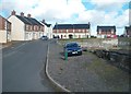
New housing estate off Lisburn Street (A49)
Image: © Eric Jones
Taken: 12 Oct 2012
0.07 miles
2
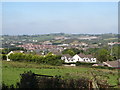
View north-eastwards across the town of Ballynahinch
The CES Quarry is a notable feature of the landscape.
Image: © Eric Jones
Taken: 29 Sep 2015
0.07 miles
3
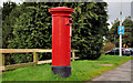
Pillar box, Ballynahinch
EIIR pillar box (BT24 131), in Lisburn Street, close to the entrance to the car park.
Image: © Albert Bridge
Taken: 3 Mar 2012
0.22 miles
4
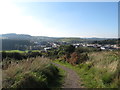
Drumlin country around Ballynahinch
This image taken from Windmill Hill shows the "basket of eggs" topography of this part of Northern Ireland.
Image: © Eric Jones
Taken: 29 Sep 2015
0.23 miles
5
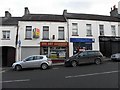
Spa Dry Cleaners / Fineline, Ballynahinch
They are located at High Street
Image: © Kenneth Allen
Taken: 25 Jan 2010
0.24 miles
6
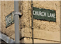
Church Lane, Ballynahinch (2)
See Image Two name signs at the Lisburn Street end of River View and Church Lane.
Image: © Albert Bridge
Taken: 3 Mar 2012
0.24 miles
7
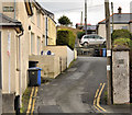
Church Lane, Ballynahinch (1)
A short street, running from Lisburn Street to Mount Eden (background). River View terrace is on the left. Image shows the unusual name signs.
Image: © Albert Bridge
Taken: 3 Mar 2012
0.25 miles