
IMAGES TAKEN NEAR TO
Mullamore Drive, BALLYNAHINCH, BT24 8RU
Introduction
This page details the photographs taken nearby to Mullamore Drive, BT24 8RU by members of the Geograph project.
The Geograph project started in 2005 with the aim of publishing, organising and preserving representative images for every square kilometre of Great Britain, Ireland and the Isle of Man.

There are currently over 7.5m images from over14,400 individuals and you can help contribute to the project by visiting https://www.geograph.org.uk
Image Map
Images are licensed for reuse under creativecommons.org/licenses/by-sa/2.0
Notes
- Clicking on the map will re-center to the selected point.
- The higher the marker number, the further away the image location is from the centre of the postcode.
Image Listing (30 Images Found)
Images are licensed for reuse under creativecommons.org/licenses/by-sa/2.0
Image
Details
Distance
1
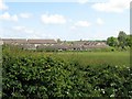
The Hillside Estate in the village of Drumaness
This image was taken from the A24 (Newcastle Road).
Image: © Eric Jones
Taken: 24 May 2016
0.04 miles
2
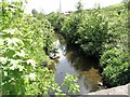
The River Cumber downstream of the A24 (Newcastle Road) bridge
The Cumber is a tributary of the Ballynahinch River, itself a tributary of the Quoile. Locally, the Cumber is also known as the Drumaness River.
Image: © Eric Jones
Taken: 24 May 2016
0.08 miles
3
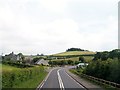
The A24 approaching McAllisters' Store at Drumaness
The former store is on the right hand side of the road.
Image: © Eric Jones
Taken: 10 Jul 2015
0.10 miles
4
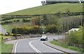
The A24 (Drumaness Road) near McAllisters Shop
The McAllisters Shop bus stop on the A24 serves estates on the south-western side of the village of Drumaness. The wooded drumlin in the background is called The Hill.
Image: © Eric Jones
Taken: 27 Apr 2012
0.10 miles
5
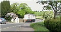
Wide load at McAllister's Corner on the A24
This fast road with its sharp corners is hazardous for both drivers and pedestrians.
http://www.thedownrecorder.co.uk/pages/?title=Bus_decision_%91dangerous%92
Image: © Eric Jones
Taken: 24 May 2016
0.10 miles
6
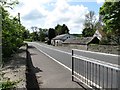
The A24 bridge over the R Cumber at Drumaness
The image was taken in the Newcastle direction. Locally, the Cumber is also known as the Drumaness River.
Image: © Eric Jones
Taken: 24 May 2016
0.11 miles
7
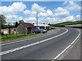
McAllister's Corner on the A24 (Newcastle Road)
This is an accident black spot. The buildings on the opposite side were those of McAllister's Store which gives its name to the bend.
Image: © Eric Jones
Taken: 24 May 2016
0.11 miles
8
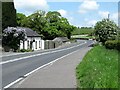
McAllister's Corner on the A24 at Drumaness
This blind bend is an accident black spot.
Image: © Eric Jones
Taken: 24 May 2016
0.11 miles
10

Mc Allister's Bus stop on the A24 at Drumaness
This is served by the Belfast-Newcastle and Lisburn to Newcastle Ulsterbus Services. There is a short path (opposite the white house) leading from the A24 to the village of Drumaness. The bus stop takes its name from McAllister's store which was located just around the corner.
Image: © Eric Jones
Taken: 24 May 2016
0.14 miles