
IMAGES TAKEN NEAR TO
Loughside Drive, BALLYNAHINCH, BT24 8PE
Introduction
This page details the photographs taken nearby to Loughside Drive, BT24 8PE by members of the Geograph project.
The Geograph project started in 2005 with the aim of publishing, organising and preserving representative images for every square kilometre of Great Britain, Ireland and the Isle of Man.

There are currently over 7.5m images from over14,400 individuals and you can help contribute to the project by visiting https://www.geograph.org.uk
Image Map
Images are licensed for reuse under creativecommons.org/licenses/by-sa/2.0
Notes
- Clicking on the map will re-center to the selected point.
- The higher the marker number, the further away the image location is from the centre of the postcode.
Image Listing (51 Images Found)
Images are licensed for reuse under creativecommons.org/licenses/by-sa/2.0
Image
Details
Distance
1
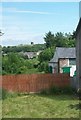
Ruined wind mill at Ballynahinch
The image was taken from Church Road.
Image: © Eric Jones
Taken: 10 Jul 2015
0.09 miles
2
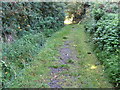
Lane linking the Windmill with the centre of Ballynahinch
Image: © Eric Jones
Taken: 29 Sep 2015
0.10 miles
3
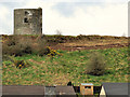
Windmill stump, Ballynahinch (2)
See Image (March 2010). The remains of the old windmill, on the top of a drumlin, dominate the landscape around much of Ballynahinch. This view, from the Crossgar Road, shows it rising above the roofs of Windmill Gardens.
Image: © Albert Bridge
Taken: 3 Mar 2012
0.11 miles
4
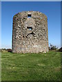
Ballynahinch Windmill
Located on the top of Windmill Hill, the ruined windmill is visible from most parts of the town. The structure dates from 1772.
Image: © Eric Jones
Taken: 29 Sep 2015
0.11 miles
5
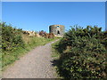
Ascending towards Ballynahinch Windmill
Located on the top of Windmill Hill, the ruined windmill is visible from most parts of the town. The structure dates from 1772.
Image: © Eric Jones
Taken: 29 Sep 2015
0.11 miles
6
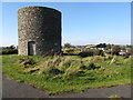
Ballynahinch iconic windmill ruin
Located on the top of Windmill Hill, the ruined windmill is visible from most parts of the town. The structure dates from 1772.
Image: © Eric Jones
Taken: 29 Sep 2015
0.11 miles
7
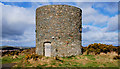
Windmill stump, Ballynahinch
The stump of a windmill on Windmill Hill. It seems that it was built as a speculative venture around 1772/3 to let to grind wheat for the production of flour. There was a suggestion that it might be restored to its original condition. Image shows the view from the Crossgar Road in March 2012.
Image: © Albert Bridge
Taken: 27 Mar 2010
0.12 miles
8
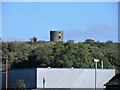
Ballynahinch's Windmill seen from the centre of the town
Image: © Eric Jones
Taken: 29 Sep 2015
0.12 miles
9
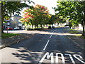
Loughside Drive, Ballynahinch
This modern residential estate leads south-eastwards from Windmill Lane.
Image: © Eric Jones
Taken: 29 Sep 2015
0.14 miles
10
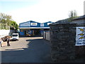
GES Electrical Wholesalers, Windmill Lane
GES is an acronym for Gordon's Electrical Supplies.
Image: © Eric Jones
Taken: 29 Sep 2015
0.15 miles