
IMAGES TAKEN NEAR TO
Ballyriver Walk, BALLYNAHINCH, BT24 8FJ
Introduction
This page details the photographs taken nearby to Ballyriver Walk, BT24 8FJ by members of the Geograph project.
The Geograph project started in 2005 with the aim of publishing, organising and preserving representative images for every square kilometre of Great Britain, Ireland and the Isle of Man.

There are currently over 7.5m images from over14,400 individuals and you can help contribute to the project by visiting https://www.geograph.org.uk
Image Map
Images are licensed for reuse under creativecommons.org/licenses/by-sa/2.0
Notes
- Clicking on the map will re-center to the selected point.
- The higher the marker number, the further away the image location is from the centre of the postcode.
Image Listing (169 Images Found)
Images are licensed for reuse under creativecommons.org/licenses/by-sa/2.0
Image
Details
Distance
1

Footbridge, Ballynahinch
Footbridge just downstream of the Dromore Street bridge Image It carries the riverside path across the Ballynahinch River.
Image: © Albert Bridge
Taken: 27 Mar 2010
0.00 miles
2

Silos, Ballynahinch (3)
See Image Another part of the same site – to the west of the previous photograph.
Image: © Albert Bridge
Taken: 5 Oct 2012
0.01 miles
3

Silos, Ballynahinch (2)
See Image (March 2010). The same silos. The site has closed and seems to have been sold for redevelopment. Image shows the adjoining buildings.
Image: © Albert Bridge
Taken: 5 Oct 2012
0.01 miles
4
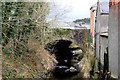
Bridge, Ballynahinch
The bridge carrying Dromore Street (formerly Bridge Street) across the Ballynahinch River. The scene of a confrontation between the Militia and the United Irishmen during the Battle of Ballynahinch in 1798.
Image: © Albert Bridge
Taken: 13 Mar 2010
0.02 miles
5
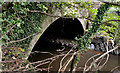
Bridge, Ballynahinch (2)
See Image (March 2010). The same bridge, from close to Dromore Street, with the river at a much higher level after what has been a wet summer and autumn.
Image: © Albert Bridge
Taken: 5 Oct 2012
0.03 miles
6
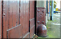
Millfield corner protection, Ballynahinch (1)
Bulbous corner protection, at a gated entry, in Dromore Street. Made by the Millfield Foundry, Belfast in 1908. Image shows the maker’s name and date of casting.
Image: © Albert Bridge
Taken: 10 Nov 2012
0.04 miles
7
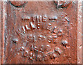
Millfield corner protection, Ballynahinch (2)
See Image The inscription “THE MILLFIELD BELFAST 1908 FOUNDRY”. It’s unusual to find the date of casting shown on the product.
Image: © Albert Bridge
Taken: 10 Nov 2012
0.04 miles
8
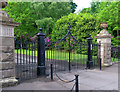
Entrance gates, Ballynahinch
Entrance gates to the Montalto Estate http://montaltoestate.com/ on the Dromore Road, Ballynahinch. They were cast by Smith and Pearson Ltd. of Dublin Image See also Image and Image for two inscriptions.
Image: © Rossographer
Taken: 3 Jun 2014
0.04 miles
9

Ballynahinch NIFRS Station
This is located in Dromore Street. Part of Southern Command, with the handle S43, it is manned by retained crews.
Image: © Eric Jones
Taken: 29 Sep 2015
0.04 miles
10
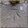
Bench Mark, Ballynahinch
Cut bench mark on the north wall of the bridge over the Ballynahinch River on the Dromore Road, Ballynahinch.
The mark is 73.20 metres above MSL.
Image: © Rossographer
Taken: 3 Jun 2014
0.04 miles