IMAGES TAKEN NEAR TO
Windmill Crescent, BALLYNAHINCH, BT24 8EZ

Introduction

This page details the photographs taken nearby to Windmill Crescent, BT24 8EZ by members of the Geograph project.

The Geograph project started in 2005 with the aim of publishing, organising and preserving representative images for every square kilometre of Great Britain, Ireland and the Isle of Man.

There are currently over 7.5m images from over14,400 individuals and you can help contribute to the project by visiting https://www.geograph.org.uk

Image Map


Images are licensed for reuse under creativecommons.org/licenses/by-sa/2.0
Notes
  • Clicking on the map will re-center to the selected point.
  • The higher the marker number, the further away the image location is from the centre of the postcode.

Image Listing (23 Images Found)

Images are licensed for reuse under creativecommons.org/licenses/by-sa/2.0
  • ...
Image
Details
Distance
1
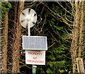
Wind turbine and solar panel, Ballynahinch
A solar panel and small wind turbine at St Colman’s High School, on the Crossgar Road.
Image: © Albert Bridge Taken: 3 Mar 2012
0.05 miles
2
St Colman's High School and Sixth Form College, Ballynahinch
This is an 11-18 mixed state school with a Catholic ethos.
Image: © Eric Jones Taken: 29 Sep 2015
0.07 miles
3
Green at Windmill Gardens
Image: © Eric Jones Taken: 29 Sep 2015
0.11 miles
4
The B7 passing new housing development
Near Ballynahinch in County Down.
Image: © James Denham Taken: 9 Feb 2009
0.11 miles
5
Pillar box, Ballynahinch
EIIR pillar box, on the Crossgar Road, close to Windmill Lane.
Image: © Albert Bridge Taken: 22 Oct 2011
0.12 miles
6
Windmill stump, Ballynahinch
The stump of a windmill on Windmill Hill. It seems that it was built as a speculative venture around 1772/3 to let to grind wheat for the production of flour. There was a suggestion that it might be restored to its original condition. Image shows the view from the Crossgar Road in March 2012.
Image: © Albert Bridge Taken: 27 Mar 2010
0.13 miles
7
Ballynahinch's Windmill seen from the centre of the town
Image: © Eric Jones Taken: 29 Sep 2015
0.13 miles
8
View east along Windmill Lane
The red brick buildings in the middle ground are at St Colman's High School and the white house is in The Sidings. Image] Image]
Image: © Eric Jones Taken: 29 Sep 2015
0.14 miles
9
Windmill stump, Ballynahinch (2)
See Image (March 2010). The remains of the old windmill, on the top of a drumlin, dominate the landscape around much of Ballynahinch. This view, from the Crossgar Road, shows it rising above the roofs of Windmill Gardens.
Image: © Albert Bridge Taken: 3 Mar 2012
0.14 miles
10
"The Sidings", Ballynahinch
The name sign at “The Sidings”, Windmill Lane, a development of houses built on (or very close to) the course of the Ballynahinch branch.
Image: © Albert Bridge Taken: 3 Mar 2012
0.14 miles
  • ...