1
Snow in Ballynahinch
A view from Edenmore Presbyterian Church's burial ground on the Dromore Road towards St. Patrick's Church (Roman Catholic) - all covered in thick snow.
Image: © Dean Molyneaux
Taken: 21 Dec 2010
0.11 miles
2
Recycling bins, Ballynahinch
A row of recycling bins, for a number of materials, at the car park off Lisburn Street.
Image: © Albert Bridge
Taken: 10 Nov 2012
0.12 miles
3
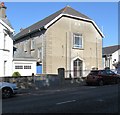
Edengrove Presbyterian Church, Dromore Road, Ballynahinch
The current church building dates from 1841. The history of the congregation dates back to the 1770s when it was set up as the 2nd Presbyterian church when a rift broke out in the congregation of the 1st Ballynahinch Presbyterian Church over what the secessionists saw as the appointment of "liberal and worldly ministers" In 1793 and again in 1829, in true Ulster fashion, there were further splits within the 2nd Presbyterian Church, with the separatists moving out to form the 3rd Ballynahinch Presbyterian Church.
Image: © Eric Jones
Taken: 29 Sep 2015
0.13 miles
4
Pillar box, Ballynahinch
EIIR pillar box at Dromore Street, inward from the Croob Road. The direction of view was chosen to hide the post-mounted drop box behind it.
Image: © Albert Bridge
Taken: 22 Oct 2011
0.14 miles
5
Ballynahinch Orange Hall, Dromore Street
Image: © Eric Jones
Taken: 29 Sep 2015
0.14 miles
6
Ballynahinch Free Presbyterian Church
This church building stands between the Orange Hall and the Masonic Lodge.
Image: © Eric Jones
Taken: 29 Sep 2015
0.14 miles
7
The junction of Grove Road and Dromore Road at Ballynahinch
Image: © Eric Jones
Taken: 29 Sep 2015
0.15 miles
8
The ornamental gates of the Montalto House Estate on Dromore Street
Montalto House a stately home with a distinguished history has in recent years been adapted to form an event centre for business and social events. The Battle of Ballynahinch between Crown forces and the United Irishmen in 1798 was fought within its demesne.
http://montaltoestate.com/about.aspx
Image: © Eric Jones
Taken: 29 Sep 2015
0.15 miles
9
Ballynahinch Town
Ballynahinch Market House (Built in 1792)
Image: © Paul Gilmore
Taken: 20 May 2004
0.15 miles
10
Magheradroll Parish Church Ballynahinch
Various parts seem to date from different times - the architecture is quite eclectic.
Image: © Brian Shaw
Taken: 27 Oct 2005
0.15 miles


