
IMAGES TAKEN NEAR TO
Todds Hill Lane, BALLYNAHINCH, BT24 7FW
Introduction
This page details the photographs taken nearby to Todds Hill Lane, BT24 7FW by members of the Geograph project.
The Geograph project started in 2005 with the aim of publishing, organising and preserving representative images for every square kilometre of Great Britain, Ireland and the Isle of Man.

There are currently over 7.5m images from over14,400 individuals and you can help contribute to the project by visiting https://www.geograph.org.uk
Image Map
Images are licensed for reuse under creativecommons.org/licenses/by-sa/2.0
Notes
- Clicking on the map will re-center to the selected point.
- The higher the marker number, the further away the image location is from the centre of the postcode.
Image Listing (83 Images Found)
Images are licensed for reuse under creativecommons.org/licenses/by-sa/2.0
Image
Details
Distance
1
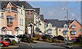
Todd's Hill Park, Saintfield
A fairly-recent development on the northern side of Todd’s Hill. Saintfield is in drumlin country which explains the slopes and stepped roofs.
Image: © Albert Bridge
Taken: 13 Apr 2013
0.03 miles
2
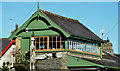
Former railway station, Saintfield
Very much a typical Belfast and County Down Railway station. The line closed in 1950 and was signalled using lower quadrant semaphores. The signal cabin was attached to the station building. Back in the mid-1970’s there was a proposal to build a Saintfield bypass here which was countered by a suggestion to re-open part of the line using steam locomotives Image Both schemes failed to materialise.
Image: © Albert Bridge
Taken: 6 Oct 2012
0.04 miles
3
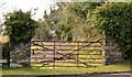
Field gate, Saintfield
A field gate beside the Station Road. Despite being close to the centre of the town and the pre-recession building boom this part of Saintfield remains undeveloped.
Image: © Albert Bridge
Taken: 13 Apr 2013
0.08 miles
4
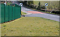
Wide verge, Saintfield
A wide verge on the Station Road. I’d guess that it was made this way to improve sight lines when the area on the left was developed for commercial use.
Image: © Albert Bridge
Taken: 13 Apr 2013
0.10 miles
5
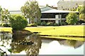
Windmill Business Park, Saintfield
Landscaped business park off the Belfast Road. Image shows a rear view in April 2013.
Image: © Albert Bridge
Taken: 15 Jul 2009
0.10 miles
6
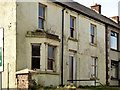
No 17 Todd's Hill, Saintfield
A vacant end-of-terrace house on the southern side of Todd’s Hill.
Image: © Albert Bridge
Taken: 13 Apr 2013
0.11 miles
7
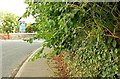
Trees over the footpath, Saintfield
Trees overhanging part of the footpath on the eastern side of the Belfast Road. A bit of a nuisance if you are pushing a buggy, have mobility problems, are blind or partially sighted or just an ordinary pedestrian . . . .
Image: © Albert Bridge
Taken: 15 Jul 2009
0.14 miles
8
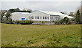
The Windmill Business Park, Saintfield (2)
Image: © Albert Bridge
Taken: 13 Apr 2013
0.15 miles
9
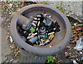
Old drinking fountain, Saintfield (3)
See Image The inside view.
Image: © Albert Bridge
Taken: 6 Oct 2012
0.15 miles
10
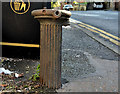
Old drinking fountain, Saintfield (2)
The remains of an old drinking fountain (no maker’s name visible) at Todd’s Hill (“Todd’s Crescent” on the Google map). Image shows the inside view.
Image: © Albert Bridge
Taken: 6 Oct 2012
0.15 miles