
IMAGES TAKEN NEAR TO
Linden Close, BALLYNAHINCH, BT24 7BH
Introduction
This page details the photographs taken nearby to Linden Close, BT24 7BH by members of the Geograph project.
The Geograph project started in 2005 with the aim of publishing, organising and preserving representative images for every square kilometre of Great Britain, Ireland and the Isle of Man.

There are currently over 7.5m images from over14,400 individuals and you can help contribute to the project by visiting https://www.geograph.org.uk
Image Map
Images are licensed for reuse under creativecommons.org/licenses/by-sa/2.0
Notes
- Clicking on the map will re-center to the selected point.
- The higher the marker number, the further away the image location is from the centre of the postcode.
Image Listing (9 Images Found)
Images are licensed for reuse under creativecommons.org/licenses/by-sa/2.0
Image
Details
Distance
1
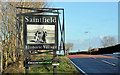
Welcome to Saintfield (2)
See Image (Belfast Road). A similar sign, depicting the Battle of Saintfield, on the Ballynahinch Road.
Image: © Albert Bridge
Taken: 7 Dec 2012
0.11 miles
2
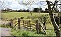
Field gates, Saintfield (April 2016)
Two gates, leading to drumlin fields, on the eastern side of the Ballynahinch Road Image
Image: © Albert Bridge
Taken: 26 Apr 2016
0.15 miles
3
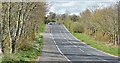
The Ballynahinch Road, Saintfield (April 2016)
The Saintfield – Ballynahinch road runs through classic Co Down drumlin country. Unfortunately the many bends and crests make it a potentially dangerous for pedestrians. The footpath ends shortly after the brow in the background. There is no significant verge. This stretch is just outside the 30mph zone.
Image: © Albert Bridge
Taken: 26 Apr 2016
0.15 miles
4
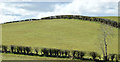
Drumlin, Saintfield - April 2016(1)
Well-rounded drumlin to the south east of the Ballynahinch Road Image
Image: © Albert Bridge
Taken: 26 Apr 2016
0.17 miles
5
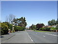
Running into Saintfield
The A21 entering the town from the south-west.
Image: © Jonathan Billinger
Taken: 17 May 2007
0.20 miles
6
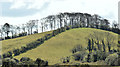
Drumlin, Saintfield - April 2016(2)
See Image (December 2012). The same drumlin, visible from the Ballynahinch Road Image, at a time of year when the sun is higher and stronger.
Image: © Albert Bridge
Taken: 26 Apr 2016
0.22 miles
7
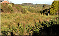
Undeveloped field, Saintfield
A field, between two areas of suburban housing, on the Middle Road, opposite Rockmount Park.
Image: © Albert Bridge
Taken: 7 Dec 2012
0.23 miles
8
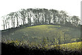
Drumlin and trees, Saintfield
Trees on a drumlin between the Ballynahinch and Listooder Roads. From a distance they resemble a rath but on closer inspection (confirmed by the satellite photograph) the trees are simply growing in a line across the top. See also Image
Image: © Albert Bridge
Taken: 7 Dec 2012
0.24 miles
9
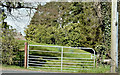
Field gate, Saintfield (April 2016)
A gate leading to a field on the north western side of the Ballynahinch Road. The field is a small piece of greenery surrounded by housing.
Image: © Albert Bridge
Taken: 26 Apr 2016
0.24 miles