1
Rivenwood, Newtownards - April 2017(3)
Houses nearing completion at the Movilla Road end of the site. Not (at the time of submission) shown on the Google map but the site appears in the satellite view.
Image: © Albert Bridge
Taken: 21 Apr 2017
0.11 miles
2
Rivenwood, Newtownards - April 2017(4)
Cycle lane approaching the Movilla Road traffic lights.
Image: © Albert Bridge
Taken: 21 Apr 2017
0.11 miles
3
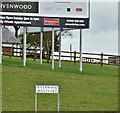
Rivenwood, Newtownards - April 2017(5)
Rivenwood Boulevard name sign beside the Movilla Road. Not (at the time of submission) shown on the Google map but the site appears in the satellite view.
Image: © Albert Bridge
Taken: 21 Apr 2017
0.11 miles
4
The Movilla Road, Newtownards (2)
The view along the Movilla Road (from Millisle), towards Newtownards and here
Image, showing the abrupt division between town and country.
Image: © Albert Bridge
Taken: 25 Oct 2011
0.11 miles
5
Rivenwood, Newtownards - June 2016(2)
The agents’ board facing the Movilla Road.
Image: © Albert Bridge
Taken: 22 Jun 2016
0.12 miles
6
Rivenwood, Newtownards - June 2016(1)
A very early stage of the earthmoving at the Movilla Road entrance to the Rivenwood development. The following is a part-quotation from the developer’s brochure ““We are building this New England dream, step by step starting with the first 100 houses. Within Phase 1 there are 4 different home types on offer, you can choose from a 2 bed semi bungalow, 3 bed semi detached, 3 bed detached or a 4 bed detached. The exterior of the houses are styled with New England clapboard cladding with a shaker style interior.”
Image: © Albert Bridge
Taken: 22 Jun 2016
0.12 miles
7
Rivenwood, Newtownards - April 2017(2)
Completed houses on the western side of Rivenwood Boulevard. Not (at the time of submission) shown on the Google map but the site appears in the satellite view. The existing Old Forge development is out of picture to the left.
Image: © Albert Bridge
Taken: 21 Apr 2017
0.13 miles
8
The Movilla Road, Newtownards (1)
The Movilla Road, to Millisle, just past the Ballyreagh Road - where the town ends on this side of Newtownards. The Google map is more than a bit awry. It shows the main road as the Ballyreagh Road but fails to mark the real Ballyreagh Road although it appears clearly on the satellite photograph. It does however show a narrow and private farm road, further to the north east. It also shows a place called “Port Rush” on town side of here – a name which appears in various Google town maps.
Image: © Albert Bridge
Taken: 25 Oct 2011
0.13 miles
9
Rivenwood, Newtownards - April 2017(1)
See
Image The new traffic arrangements at the Rivenwood access (Rivenwood Boulevard) on the Movilla Road. Not (at the time of submission) shown on the Google map but the site appears in the satellite view.
Image: © Albert Bridge
Taken: 21 Apr 2017
0.13 miles
10
Houses and fields, Newtownards
The end of Newtownards town, on the northern side of the Movilla Road
Image The houses (the Old Forge development) back onto fields.
Image: © Albert Bridge
Taken: 25 Oct 2011
0.13 miles


