IMAGES TAKEN NEAR TO
Turnstone Heights, NEWTOWNARDS, BT23 8GN

Introduction

This page details the photographs taken nearby to Turnstone Heights, BT23 8GN by members of the Geograph project.

The Geograph project started in 2005 with the aim of publishing, organising and preserving representative images for every square kilometre of Great Britain, Ireland and the Isle of Man.

There are currently over 7.5m images from over14,400 individuals and you can help contribute to the project by visiting https://www.geograph.org.uk

Image Map


Images are licensed for reuse under creativecommons.org/licenses/by-sa/2.0
Notes
  • Clicking on the map will re-center to the selected point.
  • The higher the marker number, the further away the image location is from the centre of the postcode.

Image Listing (28 Images Found)

Images are licensed for reuse under creativecommons.org/licenses/by-sa/2.0
  • ...
Image
Details
Distance
1
Strangford Lough
Image: © Mick Garratt Taken: 4 Aug 2016
0.13 miles
2
Petrol station, Newtownards (June 2016)
Independent petrol station, overlooking Strangford Lough, at the Teal Rocks, Portaferry Road.
Image: © Albert Bridge Taken: 22 Jun 2016
0.14 miles
3
White valerian, Newtownards (May 2014)
See Image (June 2013). Red valerian http://www.habitas.org.uk/flora/species.asp?item=4346 also comes in pink and white. This one was coming into flower on the north eastern side of the Portaferry Road.
Image: © Albert Bridge Taken: 26 May 2014
0.14 miles
4
The Portaferry Road, Newtownards - February 2014(1)
The Newtownards – Portaferry Road, running along the shore of Strangford Lough, near the Maltings http://www.geograph.org.uk/snippet/8823. The seawall, at the floodgates Image, is at (middle left).
Image: © Albert Bridge Taken: 28 Feb 2014
0.14 miles
5
Portaferry Rd
Image: © N Chadwick Taken: 30 Oct 2021
0.15 miles
6
"Road junction ahead" sign, Newtownards
A sign, on the Portaferry Road, approaching The Floodgates, warning of a junction with a lesser road on the right. In this case early sighting of the side road Image is hindered by a bend.
Image: © Albert Bridge Taken: 10 Apr 2013
0.16 miles
7
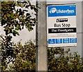
"The Floodgates" bus stop, Newtownards
Inward bus stop, on the Portaferry Road, at “The Floodgates”. The floodgates were part of the flood prevention and sea defences of Newtownards. They have been replaced Image but the name has survived.
Image: © Albert Bridge Taken: 7 Sep 2010
0.17 miles
8
The loughshore, Newtownards (July 2014)
The northern shore of Strangford Lough, at Newtownards, about 2½ hours after high water Killyleagh. The seawall Image runs across the middle.
Image: © Albert Bridge Taken: 21 Jul 2014
0.20 miles
9
Old outfall, Newtownards
I think that this is part of the remains of an old outfall, now without a pipeline, in Strangford Lough, seen from the Portaferry Road. It is clearly visible on the satellite photograph. There is a heron perched, almost motionless, as the tide rises.
Image: © Albert Bridge Taken: 26 May 2014
0.21 miles
10
The Floodgates car park, Newtownards
This small car park, on the Portaferry Road, is provided for users of the path along the seawall Image, at the northern end of Strangford Lough. What makes it a bit different is that, despite its size, it has three litter bins and one doggy bin. The tern “floodgates” is explained in Image
Image: © Albert Bridge Taken: 7 Feb 2012
0.21 miles
  • ...