
IMAGES TAKEN NEAR TO
Victoria Gardens, NEWTOWNARDS, BT23 7EG
Introduction
This page details the photographs taken nearby to Victoria Gardens, BT23 7EG by members of the Geograph project.
The Geograph project started in 2005 with the aim of publishing, organising and preserving representative images for every square kilometre of Great Britain, Ireland and the Isle of Man.

There are currently over 7.5m images from over14,400 individuals and you can help contribute to the project by visiting https://www.geograph.org.uk
Image Map
Images are licensed for reuse under creativecommons.org/licenses/by-sa/2.0
Notes
- Clicking on the map will re-center to the selected point.
- The higher the marker number, the further away the image location is from the centre of the postcode.
Image Listing (46 Images Found)
Images are licensed for reuse under creativecommons.org/licenses/by-sa/2.0
Image
Details
Distance
1
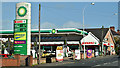
BP and Spar, Newtownards (September 2017)
BP petrol station and Spar shop on the Bangor Road. The shop has solar panels on the roof.
Image: © Albert Bridge
Taken: 29 Sep 2017
0.10 miles
2
Spar Store on the Bangor Road, Newtownards
Image: © Eric Jones
Taken: 17 Apr 2017
0.10 miles
3
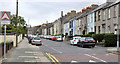
Victoria Avenue, Newtownards
A long street, mainly terrace houses, running uphill from East Street and Windmill Row to Upper North Street, with the inevitable traffic-calming humps. Looking downhill it has a view over Strangford Lough.
Image: © Albert Bridge
Taken: 26 Jun 2011
0.13 miles
4
Ascending northwards along Bangor Road, Newtownards
Image: © Eric Jones
Taken: 17 Apr 2017
0.15 miles
5
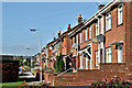
East Street, Newtownards (September 2017)
See Image (February 2011). A complete contrast in architectural styles – a cul-de-sac of brick social housing at the roundabout end of East Street.
Image: © Albert Bridge
Taken: 29 Sep 2017
0.15 miles
6
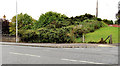
Old railway, Newtownards (1)
61 years after the Belfast and County Down lines from Belfast to Donaghadee (via Comber and Newtownards) closed there are few visible signs that Newtownards ever had a railway.
This part of the course of the line survives on the western side of the Bangor Road. Post-closure vegetation makes it look like an embankment but the 1963 one-inch map shows it as a cutting.
Image shows the course of the line on the other side of the road.
Image: © Albert Bridge
Taken: 11 Aug 2011
0.15 miles
7
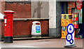
Pillar box, Newtownards
EIIR pillar box at the Bangor Road end of East Street Image
Image: © Albert Bridge
Taken: 7 Feb 2011
0.16 miles
8
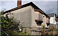
Vacant house, Newtownards (3)
Vacant and boarded-up bungalow, at the corner of the Bangor Road (behind me) and Belvedere Road, awaiting the end of the recession.
Image: © Albert Bridge
Taken: 9 Sep 2011
0.17 miles
9
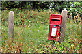
Letter box, Newtownards
EIIR letter box, mounted on a fence post, on the Bangor Road. The old railway to Donaghadee Image is in the background.
Image: © Albert Bridge
Taken: 11 Aug 2011
0.17 miles
10
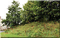
Old railway, Newtownards (2)
See Image The course of the line on the other (eastern) side of the Bangor Road. The line continued towards Ballygrainey and Donaghadee Image Continue to Image
Image: © Albert Bridge
Taken: 11 Aug 2011
0.17 miles