
IMAGES TAKEN NEAR TO
Frances Street, NEWTOWNARDS, BT23 7DY
Introduction
This page details the photographs taken nearby to Frances Street, BT23 7DY by members of the Geograph project.
The Geograph project started in 2005 with the aim of publishing, organising and preserving representative images for every square kilometre of Great Britain, Ireland and the Isle of Man.

There are currently over 7.5m images from over14,400 individuals and you can help contribute to the project by visiting https://www.geograph.org.uk
Image Map
Images are licensed for reuse under creativecommons.org/licenses/by-sa/2.0
Notes
- Clicking on the map will re-center to the selected point.
- The higher the marker number, the further away the image location is from the centre of the postcode.
Image Listing (142 Images Found)
Images are licensed for reuse under creativecommons.org/licenses/by-sa/2.0
Image
Details
Distance
1
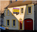
No 50 Frances Street, Newtownards
A house of similar design to many in Newtownards. Described by the agent as “Excellent redevelopment opportunity with planning approval granted for for (sic) mixed use of ground floor shop/office, two apartments above and one mews house to rear. Alternative options include commercial usage of the yard and outbuildings or the entire redeveloped building could be used for non-residential purposes subject to planning permission.” Fortunately the word “demolition” is not mentioned. This Image is beside the down spout.
Image: © Albert Bridge
Taken: 9 Jan 2011
0.01 miles
2
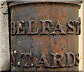
Milepost detail, Newtownards
The destinations on this milepost Image in Frances Street.
Image: © Albert Bridge
Taken: 9 Jan 2011
0.01 miles
3
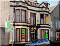
No 47 Frances Street, Newtownards
Currently vacant property described by the agent as a former funeral home with outline planning permission granted for demolition and six apartments.
Image: © Albert Bridge
Taken: 9 Jan 2011
0.03 miles
4
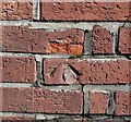
Bench Mark, Newtownards
Cut bench mark located on the corner of a building on Frances Street in Newtownards, at the corner with Windmill Row.
The mark is 12.74 metres above MSL.
See also http://www.geograph.org.uk/search.php?i=11037856 for many other examples I have found.
Image: © Rossographer
Taken: 1 Apr 2010
0.04 miles
5
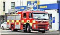
Fire appliance, Newtownards - July 2015 (3)
See Image One of the three appliances in attendance at premises in Frances Street.
Image: © Albert Bridge
Taken: 20 Jul 2015
0.04 miles
6
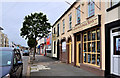
118 Frances Street, Newtownards
Regrettably, there are more than a few bits of dereliction in the centre of Newtownards http://www.geograph.org.uk/search.php?i=22624577. 118 Frances Street (which might date from the early 19th century) is not among their number. In immaculate condition, it houses a retailer of glass and glassware.
Image: © Albert Bridge
Taken: 26 Jun 2011
0.04 miles
7
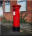
Postbox, Newtownards
Elizabeth II postbox on Frances Street, Newtownards.
Image: © Rossographer
Taken: 1 Apr 2010
0.04 miles
8
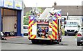
Fire appliance, Newtownards - July 2015 (1)
One of three appliances in attendance at premises in Frances Street. There was no smoke or water but they stayed much longer than might be expected in the case of a false alarm. See also Image and Image
Image: © Albert Bridge
Taken: 20 Jul 2015
0.04 miles
9
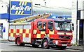
Fire appliance, Newtownards - July 2015 (2)
See Image One of the three appliances in attendance at premises in Frances Street. Continue to Image
Image: © Albert Bridge
Taken: 20 Jul 2015
0.05 miles
10
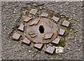
Stop-valve cover, Newtownards
A small (diameter of 4 inches) stop-valve cover, at the Frances Street end of Windmill Row.
Image: © Albert Bridge
Taken: 26 Jun 2011
0.05 miles