IMAGES TAKEN NEAR TO
Hillcrest Avenue, NEWTOWNARDS, BT23 7AW

Introduction

This page details the photographs taken nearby to Hillcrest Avenue, BT23 7AW by members of the Geograph project.

The Geograph project started in 2005 with the aim of publishing, organising and preserving representative images for every square kilometre of Great Britain, Ireland and the Isle of Man.

There are currently over 7.5m images from over14,400 individuals and you can help contribute to the project by visiting https://www.geograph.org.uk

Image Map


Images are licensed for reuse under creativecommons.org/licenses/by-sa/2.0
Notes
  • Clicking on the map will re-center to the selected point.
  • The higher the marker number, the further away the image location is from the centre of the postcode.

Image Listing (23 Images Found)

Images are licensed for reuse under creativecommons.org/licenses/by-sa/2.0
  • ...
Image
Details
Distance
1
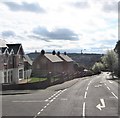
North Road descending towards the centre of Newtownards
Image: © Eric Jones Taken: 17 Apr 2017
0.03 miles
2
Ulster Foundries access cover, Newtownards
An Ulster Foundries access cover, on the North Road Image, at the end of the Glenburn Road. It differs from other Ulster Foundries covers Image Image in size (29 inches square) and in giving the foundry’s address as Lisburn rather than Belfast.
Image: © Albert Bridge Taken: 9 Sep 2011
0.04 miles
3
Vacant house, Newtownards (1)
Vacant and boarded-up detached house, on the North Road, awaiting the end of the recession. There is another beside it and a large vacant site on the north eastern side of both.
Image: © Albert Bridge Taken: 9 Sep 2011
0.05 miles
4
The North Road, Newtownards
Newtownards sits, at sea level, at the northern end of Strangford Lough. Much of the surrounding area is higher ground as shown by the North Road descending from the Bangor Road towards the town centre. The view is from beside the Glenburn Road.
Image: © Albert Bridge Taken: 9 Sep 2011
0.06 miles
5
South Eastern Regional College, Newtownards Campus
This college stands in Victoria Avenue.
Image: © Eric Jones Taken: 2 Aug 2013
0.10 miles
6
The junction of Upper North Street and Talbot Street, Newtownards
Image: © Eric Jones Taken: 17 Apr 2017
0.12 miles
7
Letter box, Newtownards
Post-mounted EIIR letter box, in Upper North Street, near the corner of Talbot Street (behind me).
Image: © Albert Bridge Taken: 26 Jun 2011
0.12 miles
8
Talbot Street, Newtownards
Talbot Street is part of the route connecting the Belfast road to the Bangor Road, avoiding the town centre. The long tract of undeveloped land (right) makes me wonder whether it was once intended as the site of an inner ring road which was never built. See also Image
Image: © Albert Bridge Taken: 9 Sep 2011
0.13 miles
9
Marquis Street, Newtownards
Another of the straight streets in Newtownards. Marquis Street runs from Talbot Street to Mark Street (background).
Image: © Albert Bridge Taken: 9 Sep 2011
0.17 miles
10
View north along North Street, Newtownards
Image: © Eric Jones Taken: 2 Aug 2013
0.18 miles
  • ...