
IMAGES TAKEN NEAR TO
Gorsehill Glen, NEWTOWNARDS, BT23 6XD
Introduction
This page details the photographs taken nearby to Gorsehill Glen, BT23 6XD by members of the Geograph project.
The Geograph project started in 2005 with the aim of publishing, organising and preserving representative images for every square kilometre of Great Britain, Ireland and the Isle of Man.

There are currently over 7.5m images from over14,400 individuals and you can help contribute to the project by visiting https://www.geograph.org.uk
Image Map
Images are licensed for reuse under creativecommons.org/licenses/by-sa/2.0
Notes
- Clicking on the map will re-center to the selected point.
- The higher the marker number, the further away the image location is from the centre of the postcode.
Image Listing (11 Images Found)
Images are licensed for reuse under creativecommons.org/licenses/by-sa/2.0
Image
Details
Distance
1
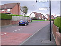
Church Road, Moneyreagh
Entering the village from the Hillsborough Road.
Image: © Dean Molyneaux
Taken: 25 Oct 2009
0.09 miles
2
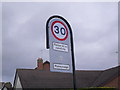
Entering Moneyreagh
Located on the Church Road. Note the minuscule insignia of Castlereagh Borough Council.
Image: © Dean Molyneaux
Taken: 25 Oct 2009
0.10 miles
3
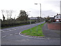
Hillsborough Road at Moneyreagh
The B178 Hillsborough to Comber Road at the junction with Church Road in Moneyreagh.
Image: © Dean Molyneaux
Taken: 25 Oct 2009
0.11 miles
4
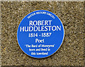
Robert Huddleston plaque, Moneyrea
A recently-erected plaque, near the Non-Subscribing Presbyterian Church Image, commemorating Robert Huddleston http://www.ulsterhistory.co.uk/huddleston.html. See also Image (April 2014).
Image: © Albert Bridge
Taken: 29 Jul 2014
0.14 miles
5
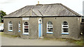
Former National School, Moneyrea - July 2014(1)
The former Moneyrea National School (1840/1908), still standing beside the Church Road, looking very much as built (save for the PVC windows). More information here http://www.doeni.gov.uk/niea/content-databases-buildview?id=15949&js=true. Image shows the name plaque.
Image: © Albert Bridge
Taken: 29 Jul 2014
0.14 miles
6
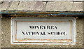
Former National School, Moneyrea - July 2014(2)
See Image The name plaque facing the Church Road
Image: © Albert Bridge
Taken: 29 Jul 2014
0.14 miles
7
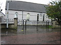
Moneyrea Non-subscribing Presbyterian Church
The Congregation was founded in 1719, while this building dates from 1770.
Image: © Brian Shaw
Taken: 31 Oct 2005
0.16 miles
8
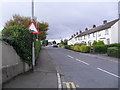
Rockland Drive, Moneyreagh
Off Church Road.
Image: © Dean Molyneaux
Taken: 25 Oct 2009
0.16 miles
9
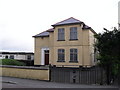
Moneyreagh Masonic Hall
It is located on Church Road. The plaque above the door suggests that Lodge No. 556 convenes here.
Image: © Dean Molyneaux
Taken: 25 Oct 2009
0.18 miles
10
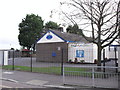
Moneyrea Primary School
Note spelling variation (Moneyrea/Moneyreagh). Located on Church Road.
Image: © Dean Molyneaux
Taken: 25 Oct 2009
0.20 miles