
IMAGES TAKEN NEAR TO
Ballymorran Road, NEWTOWNARDS, BT23 6UB
Introduction
This page details the photographs taken nearby to Ballymorran Road, BT23 6UB by members of the Geograph project.
The Geograph project started in 2005 with the aim of publishing, organising and preserving representative images for every square kilometre of Great Britain, Ireland and the Isle of Man.

There are currently over 7.5m images from over14,400 individuals and you can help contribute to the project by visiting https://www.geograph.org.uk
Image Map
Images are licensed for reuse under creativecommons.org/licenses/by-sa/2.0
Notes
- Clicking on the map will re-center to the selected point.
- The higher the marker number, the further away the image location is from the centre of the postcode.
Image Listing (6 Images Found)
Images are licensed for reuse under creativecommons.org/licenses/by-sa/2.0
Image
Details
Distance
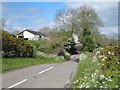
2
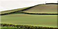
Drumlin near Killinchy (1)
The south western side of a classic east Down drumlin, beside the Ballymorran Road, opposite the Quarterland Road. Image shows the other side of the same drumlin.
Image: © Albert Bridge
Taken: 4 May 2012
0.13 miles
3
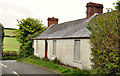
Old cottage near Killinchy
An old cottage at the Ballymorran Road end of the Quarterland Road. The Google satellite photograph shows that a large rear garden compensates for the absence of one at the front.
Image: © Albert Bridge
Taken: 4 May 2012
0.14 miles
4
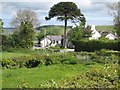
Monkey Puzzle
In the garden of a house overlooking Ballymorran Bay.
Image: © Oliver Dixon
Taken: 11 May 2007
0.15 miles
5
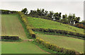
Drumlin near Killinchy (2)
See Image The north eastern side of the same drumlin.
Image: © Albert Bridge
Taken: 4 May 2012
0.15 miles
6
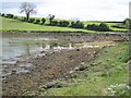
Southern corner of Ballymorran Bay
An arm of Strangford Lough.
Image: © Oliver Dixon
Taken: 11 May 2007
0.19 miles