
IMAGES TAKEN NEAR TO
Ardarawood, NEWTOWNARDS, BT23 5UB
Introduction
This page details the photographs taken nearby to Ardarawood, BT23 5UB by members of the Geograph project.
The Geograph project started in 2005 with the aim of publishing, organising and preserving representative images for every square kilometre of Great Britain, Ireland and the Isle of Man.

There are currently over 7.5m images from over14,400 individuals and you can help contribute to the project by visiting https://www.geograph.org.uk
Image Map
Images are licensed for reuse under creativecommons.org/licenses/by-sa/2.0
Notes
- Clicking on the map will re-center to the selected point.
- The higher the marker number, the further away the image location is from the centre of the postcode.
Image Listing (36 Images Found)
Images are licensed for reuse under creativecommons.org/licenses/by-sa/2.0
Image
Details
Distance
1
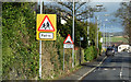
Road signs, Comber (February 2016)
“School” and “humps” signs at Railway Street. Traffic-calming measures, in the form of road humps, is widespread throughout NI.
Image: © Albert Bridge
Taken: 8 Feb 2016
0.07 miles
2
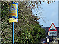
"Highway to Health" sign, Comber (February 2016)
The “Highway to Health” is series of signposted urban walking routes found throughout NI. This sign is on the Ballygowan Road (High Street on the Google map), Comber. The best-known route is in Omagh http://www.geograph.org.uk/of/Highway%20to%20health%20%20omagh.
Image: © Albert Bridge
Taken: 8 Feb 2016
0.07 miles
3
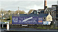
The Mill Village, Comber (February 2016)
See Image (August 2013) and Image (January 2012). New houses, described by one of the joint agents as “Stunning affordable and sustainable Turnkey Homes”, now under construction on the cleared sites, between Railway Street and High Street. This photograph appears as a matter of record only. I have no connection with the building or sale of the properties. Continue to Image
Image: © Albert Bridge
Taken: 8 Feb 2016
0.08 miles
4
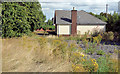
Vacant bungalow, Comber
A vacant bungalow, in an overgrown garden, at the corner of Railway Street and High Street (behind me).
Image: © Albert Bridge
Taken: 21 Aug 2013
0.09 miles
5
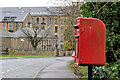
Letter box, Comber
Post-mounted EIIR letter box on the Ballygowan Road (High Street on the Google map), almost opposite Railway Street. The former Andrews Mill Image is in the background.
Image: © Albert Bridge
Taken: 4 Jan 2012
0.09 miles
6
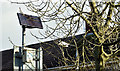
Solar panel, Comber (February 2016)
A south-facing solar panel, powering the flashing lights on a north-facing “school” sign, at the High Street/Ballygowan Road end of Railway Street.
Image: © Albert Bridge
Taken: 8 Feb 2016
0.10 miles
7
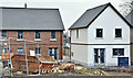
The Mill Village, Comber (January 2017)
See Image Some of the new houses, now under construction, seen from Railway Street. Continue to Image
Image: © Albert Bridge
Taken: 26 Jan 2017
0.10 miles
8
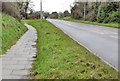
The Ballygowan Road, Comber
The Ballygowan Road (to Ballygowan and Saintfield), just outside the centre of Comber, as it approaches Clattering Ford Image (top left - at the national speed limit sign).
Image: © Albert Bridge
Taken: 4 Jan 2012
0.11 miles
9
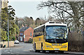
School bus, Comber (January 2017)
An Education Authority Volvo (FXZ 6450), with a Plaxton Leopard body, parked outside the Andrews Memorial Hall Image on the Ballygowan Road.
Image: © Albert Bridge
Taken: 26 Jan 2017
0.12 miles
10
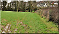
Field, Comber (1)
One of the remaining undeveloped fields on the south western side of Comber. The houses (background) ate on the Old Ballygowan Road. The view is from the present Ballygowan Road Image
Image: © Albert Bridge
Taken: 4 Jan 2012
0.14 miles