
IMAGES TAKEN NEAR TO
Ballygraffan Road, NEWTOWNARDS, BT23 5SU
Introduction
This page details the photographs taken nearby to Ballygraffan Road, BT23 5SU by members of the Geograph project.
The Geograph project started in 2005 with the aim of publishing, organising and preserving representative images for every square kilometre of Great Britain, Ireland and the Isle of Man.

There are currently over 7.5m images from over14,400 individuals and you can help contribute to the project by visiting https://www.geograph.org.uk
Image Map
Images are licensed for reuse under creativecommons.org/licenses/by-sa/2.0
Notes
- Clicking on the map will re-center to the selected point.
- The higher the marker number, the further away the image location is from the centre of the postcode.
Image Listing (9 Images Found)
Images are licensed for reuse under creativecommons.org/licenses/by-sa/2.0
Image
Details
Distance
1

The Ballygraffin Road near Comber (2)
The north eastern end of the Ballygraffan Road Image, close to the Ballydrain Road, alive with cow parley.
Image: © Albert Bridge
Taken: 1 Jun 2012
0.05 miles
2

The Ballydrain Road near Castle Espie
The Ballydrain Road north of Castle Espie heading back towards Comber.
Image: © Rossographer
Taken: 10 May 2025
0.10 miles
3

Modern two-storey house
This house is off Ballydrain Road.
Image: © Brian Shaw
Taken: 15 Mar 2006
0.12 miles
4
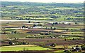
The view from Scrabo (6)
See Image The view south with the Comber River meandering across the middle of the photo.
Image: © Albert Bridge
Taken: 9 May 2009
0.14 miles
5

Coastal grasses near Comber
Coastal grass growing in the damp ground, beside this stream Image, at the Cullintraw Bridge on the Ballydrain Road. Scrabo Tower Image is at top right. The Google map and the satellite photograph do not coincide.
Image: © Albert Bridge
Taken: 1 Jun 2012
0.18 miles
6

Windmill stump near Comber
The stump of an old windmill, to the south east of Comber, beside the Ballygraffan Road Image (behind the hedge on the left).
Image: © Albert Bridge
Taken: 22 Jun 2010
0.19 miles
7

Strangford Lough
An inlet and reed beds beside the Ballydrain Road.
Image: © Robert Ashby
Taken: 22 Apr 2015
0.19 miles
8

Tidal stream near Comber
The western side of Strangford Lough has many creeks, inlets and tidal streams. This tidal stream (not named on the 1:25,000 map) is narrow but becomes much wider as it enters the lough. The view is from the Cullintraw Bridge on the Ballydrain Road Image The Google map and the satellite photograph do not coincide.
Image: © Albert Bridge
Taken: 1 Jun 2012
0.20 miles
9

Hedge near Comber
A hedge running along a track, off the Ballygraffan Road Image When seen from the south it looks exactly like the remains of an old railway (except that there were no railways near here).
Image: © Albert Bridge
Taken: 22 Jun 2010
0.24 miles